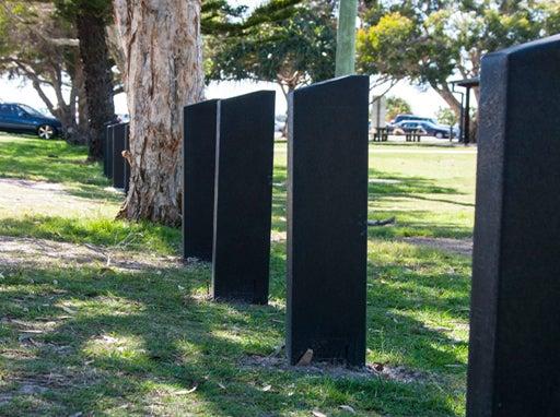
Bollards
Site planning
Best practice guidance for site planning
Decision framework
There are a range of Australian Standards/best practice guidelines, relating to this category. Key documents are referenced throughout and in the LIM Bollards - Standards.
Risk evaluation (for bollards near roads)
The risk evaluation process detailed in the Austroads Guide to Road Design Part 6 is the default requirement for use on roads. The Council may however choose to approve the use of an alternate process such as ‘generalised hazard assessment process’ if considered more appropriate in context. The design report should document this decision and the details of the alternate risk assessment evaluation process. Consult RPEQ.
Banana bars
The use of ‘banana bars’ is NOT supported by council due to the following:
- Banana bars are a yellow painted round section ‘u’ shaped metal pipe device installed adjacent to pathways as a cyclist slow down treatment. The upper ‘u’ section of the bar is bent in towards the pathway to encourage reduced cyclist speed and to provide a cyclist holding rail if required. This device is no longer supported by DTMR (Queensland Department of Transport and Main Roads). See Austroads Guide to Road Design Part 6A: Paths for walking and cycling, for bollards located to the edge of, or in the centre of a path.
Site decisions
All decisions, including the location of the embellishment and related infrastructure, must be made in conjunction with council (determined by site location), including officers from such areas as:
- Council (Parks and Gardens)
- Council (Environmental Operations)
- Bollard use should be minimised where possible. Use garden beds, plants, trees or high kerbs instead of bollards.
- Locate bollards at the boundary between parks and parking areas to deter unauthorised vehicle entry.
Users
Consult with council stakeholders, neighbouring properties and identified park users in the planning stage of a project.
Site conditions
Consider the physical characteristics of a site and requirements of the activities to be conducted:
- location of utilities.
Co-location of facilities
- Facilities, including parking and pathways, are often already established and need to be considered in the determination of bollard location.
Safety
- Safety clearances must be met.
- Removable bollards located in the middle of pathways should only be used where a risk assessment recommends them.
Planning and design for the protection of people in crowded places
In recent years, terrorist attacks using vehicles targeting public places have increased and therefore the need for specifically designed protective measures has become important.
The general recommendation is to avoid bollards as counter-terrorism protective measures. Instead of bollards, implement “safe places by design” by using the natural environment and appropriate landscape design.
At the same time, public places have a need to be open, welcoming and attractive. Too many barriers will create a perception of “barricades” and will hamper openness.
For further information and technical resources see the following documents:
- Hostile Vehicle Guidelines for Crowded Places - Australia-New Zealand National Counter-Terrorism Committee (ANZCTC).
- Queensland Counter-Terrorism Strategy 2013-2019 – Qld Government.
Potential site conflicts
Locate bollards away from:
- High use bikeways, busy roads and steep slopes, to avoid accidents.
- Avoid interfering with other open space uses. Bollards installed too close to the edge of pathways will interrupt the free flow of pedestrian/cyclist traffic.
- Hazards such as waterways, fire and flood prone areas, sewers and stormwater drains, underground services.
Planning for sustainability
Refer Design principles – Sustainability for guidance.
Planning for future works
- Co-locate embellishments requiring similar services e.g. water, to reduce infrastructure, where possible.
- Where underground utilities are installed, set brass markers to concrete slab edges to indicate the location.
- Consider installation of additional conduits under concrete slabs for future provision, where utilities (e.g. electrical, water) and irrigation systems are planned. Ensure additional conduit is capped to prevent ingress of water and debris.
- Consider climate change impacts on the embellishment location and construction 1.
- In coastal areas, or near waterways, design should consider rise in sea level predictions, storm tide, salt inundation and severe storm events.
- Positioning should also consider flooding, seasonal/ephemeral water bodies and water table changes.
- Near bushland areas, design should consider the occurrence of bushfires.
Source 1: Sunshine Coast Environment and Liveability Strategy 2017.
This component is currently in development