Water sensitive urban design (WSUD)
Positioning
Best practice guidance for the placement and arrangement of embellishments
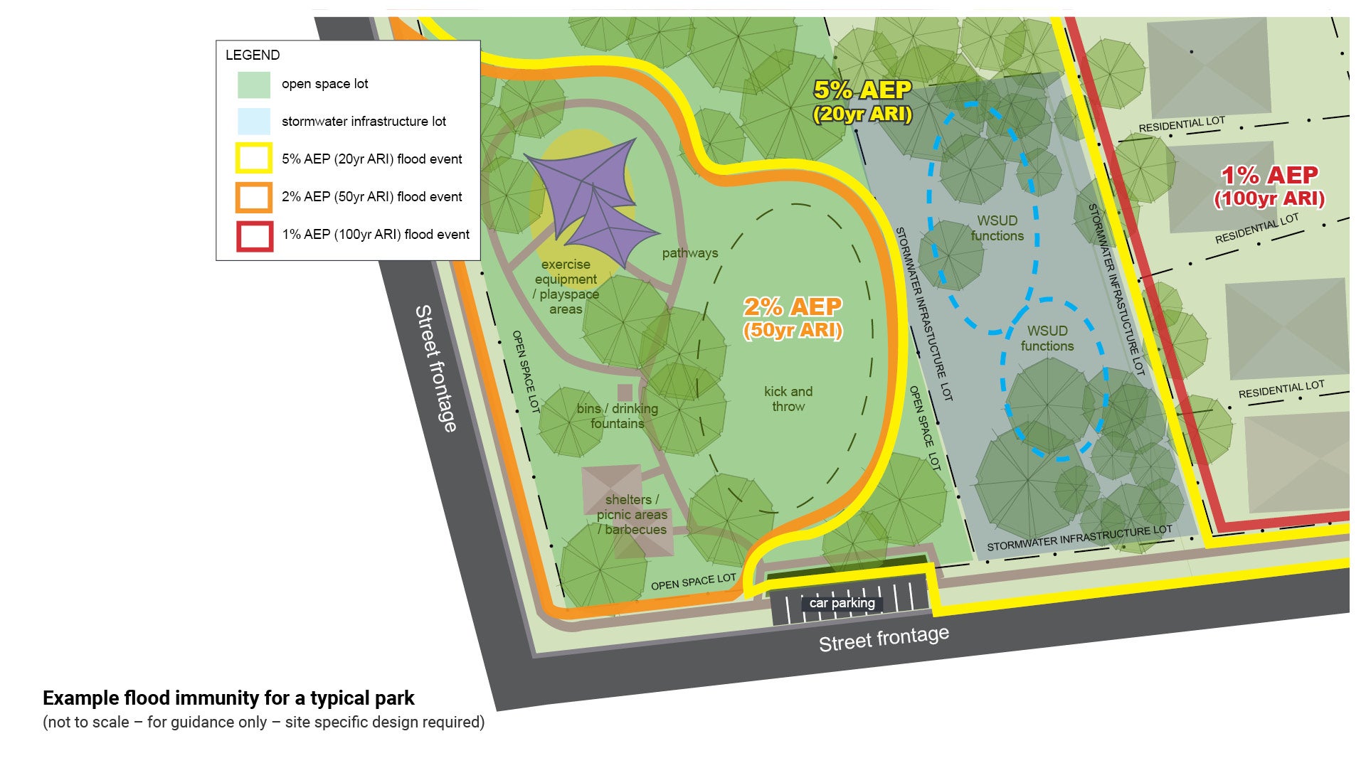
Flood immunity
The Environment and Liveability Strategy (ELS) states the following park types require flood immunity considerations:
- Land above 5% AEP (1 in 20).
- Key infrastructure and activity areas (i.e. playgrounds/exercise equipment, picnic/kick and throw spaces, bins, pathways, fencing, access and car parking etc.) above 2% AEP (1 in 50).
- Buildings/structures (e.g. public amenities) above 1% AEP (1 in 100).
- Stormwater flows do not compromise function or safety in the park.
- Land above 5% AEP (1 in 20).
- Key infrastructure and activity areas (i.e. playgrounds/exercise equipment, picnic/kick and throw spaces, bins, pathways, fencing, access and car parking etc.) above 2% AEP (1 in 50).
- Buildings/structures above 1% AEP (1 in 100).
- Park layout designed so that stormwater flows do not compromise function or safety in the park.
- Land above 5% AEP (1 in 20).
- Key infrastructure and activity areas (i.e. playgrounds/exercise equipment, picnic/kick and throw spaces, bins, pathways, fencing, etc.) above 2% AEP (1 in 50).
- Structures above 1% AEP (1 in 100).
- Park layout designed so that stormwater flows do not compromise function or safety in the park.
- All land and infrastructure above 1% AEP (1 in 100).
- Park layout designed so stormwater flows do not compromise function or safety in the park.
- N/A
- Key infrastructure (i.e. exercise equipment, bins,pathways, fencing, etc.) above 5% AEP (1 in 20).
- Park layout designed so that stormwater flows do not compromise function or safety in the park.
- Playing fields above 5% AEP (1 in 20).
- Key infrastructure and activity areas (i.e. bins, pathways, fencing, access and car parking etc.) above 2% AEP (1 in 50).
- Buildings/structures above 1% AEP (1 in 100).
- Designed so that stormwater flows do not compromise function or safety in the park and fields allow sufficient drainage following a rain event.
- Key infrastructure and activity areas (i.e. bins,pathways, fencing, access and car parking etc.) above 2% AEP (1 in 50).
- Buildings/structures above 1% AEP (1 in 100).
- Designed so that stormwater flows do not compromise function or safety in the park and fields allow sufficient drainage following a rain event.
The ELS offers no specific advice on flood immunity for different types of reserve parcels, however it has the following information for waterways and wetlands:
- Opportunities for vegetated buffers wider than minimum are investigated where:
- they would improve connectivity between priority biodiversity habitat areas, or
- the 1% AEP (1 in 100) flood hazard area extends further out from a waterway than the minimum buffers.
See Figure 25: Example flood immunity for a typical park.
Figure 25: Example flood immunity for a typical park
Co-location vs integration
Stormwater infrastructure and overland flow paths are often located in areas used for multiple purposes, such as parks, environmental reserves, roads and carparks. These multiple uses cannot be completely separated without adverse impacts on the existing community and environment.
Co-location and integration of uses needs to be understood and appropriately accommodated in a manner that is complementary and in doing so does not compromise any one use and ensures that safety, equity and amenity are maintained. If done well, the complementary co-location of uses can enhance the urban environment and improve the function of the stormwater network. (Source: Sunshine Coast Council Stormwater Management Strategy).
Position stormwater treatment devices as per Council's Flooding and Stormwater Management Guidelines.
Stormwater treatment facilities and recreational areas can be positioned in a way to provide:
- Co-location with WSUD - greenfield site (adjacent and complementary)
- Integration with WSUD - in existing open space (combined compatible uses).
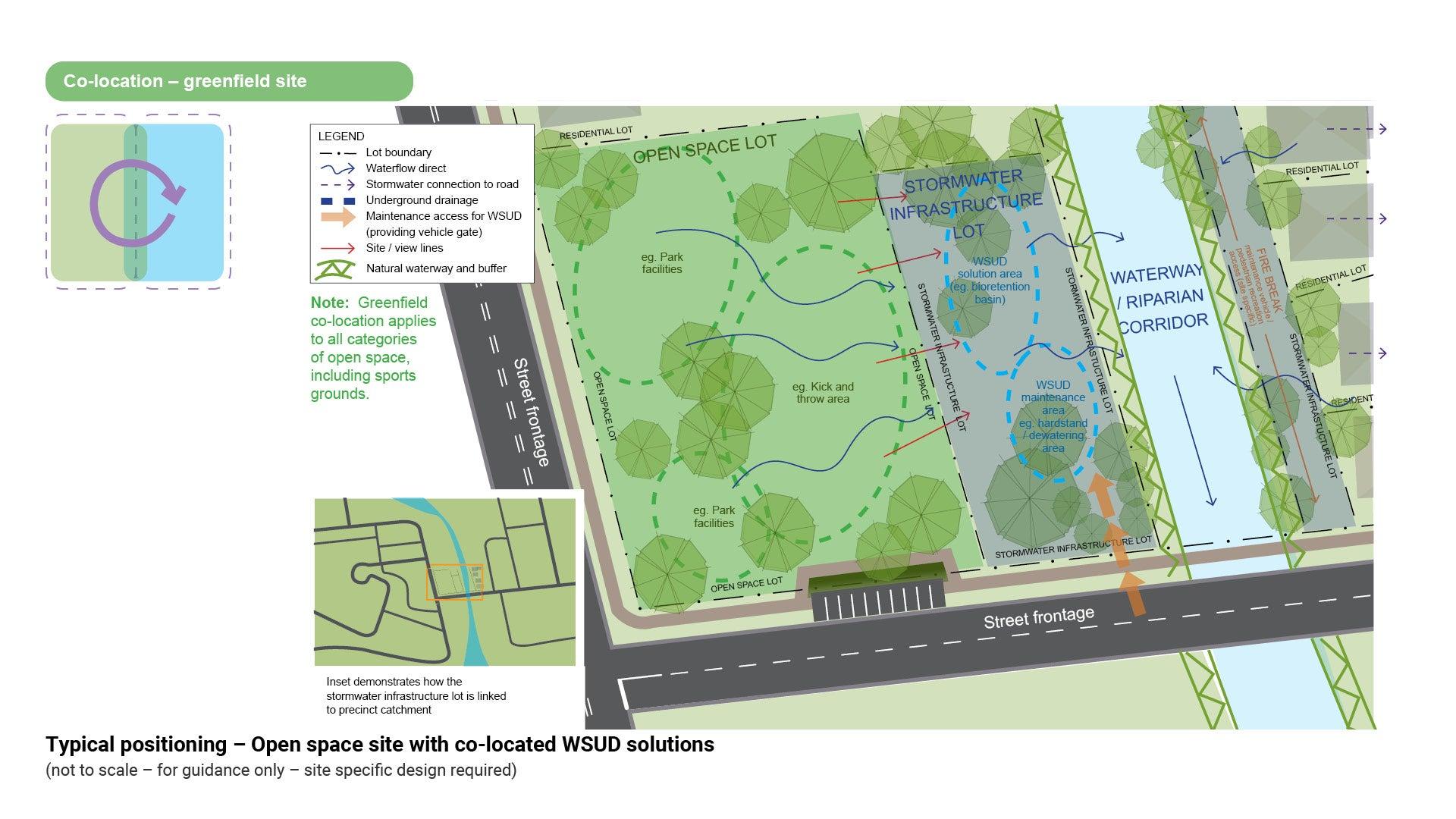
Co-location with WSUD – greenfield site

Adjacent, and complementary
Co-location – In greenfield developments (new undeveloped sites), stormwater infrastructure is to be co-located within a lot adjacent to open space. Co-location maximises overall benefits for the community, ecology and amenity and avoids land intended as open space from being constrained.
Stormwater treatment and flow management structures are commonly co-located with parks, sportsgrounds and other areas at the boundary between the natural and built environments.
Land designated for a stormwater purpose must be co-located with adjacent open space areas. It must be positioned in order to maximise the overall benefits including amenity and ecological enhancement.
Land designated for a stormwater purpose is to be located outside of the required riparian buffer areas and does not count towards the minimum land required for open space.
Key considerations for complementary co-location of stormwater with open space is:
- if an existing stormwater function has been identified
- to avoid fragmentation of functions
- minimise level differences
- reduce hazards associated with the stormwater treatment to eliminate the need for fencing or retaining walls
- land topography.
Co-location provides:
- Improved recreational outcomes, as it allows for separate recreation functions to exist whilst minimising user conflicts.
- Improved visual amenity, as it ensures that maximum open space opportunities remain for the recreational users.
- Improved functionality:
- improved stormwater quality and quantity outcomes on a separate parcel of land, that is specifically designed and designated for that utility. It allows for separate management and maintenance activities.
- compliance with minimum Desired Standards of Service (DSS) presented in the ELS. This ensures the desired role and function of each open space category can be achieved (i.e. provision rate, size, shape, road frontage, flood immunity).
- Open space will still be required to manage stormwater runoff generated by that site.
- New open space lots are NOT intended to be used to manage stormwater runoff generated from off site - this is the intent of the adjacent and complementary stormwater lot. Any existing stormwater functions should be identified during the planning and design phase and accounted for accordingly.
- Stormwater quality infrastructure such as GPTs, streetscape raingardens, gully pits (including baskets), passive irrigation for street trees, etc., should be located to the greatest extent possible within road reserve or drainage easement, rather than in the open space.
The site specific design would be dependent on:
- the site location and conditions
- the type and function of the WSUD (including maintenance requirements)
- different opportunities for social experience and observation that exist/opportunities for interactions with the device.
The following positioning solution method is designed to illustrate how co-located land parcels could interact.
See Figure 26: Example flood event map – Open space site with co-located WSUD solutions.
Integration with WSUD – in existing open space

Combined compatible uses
Integration – The complementary integration of WSUD into existing open space needs to holistically consider the use of the space for community, ecological and amenity purposes. If an existing stormwater overland flow or storage function is identified, WSUD infrastructure could be located within that non-functional open space, thereby avoiding the functional open space and any impacts on it. The delivery of WSUD infrastructure should occur in a manner that improves the effective functionality and resilience of the recreation, sport and environmental open space.
Stormwater treatment is to be complementary and integrated within the public realm, using natural processes to the greatest extent possible.
Open space areas are to be protected from utility encroachment. In situations where new development is delivered adjacent to existing open space, and has a need to connect stormwater discharging from the new development to a receiving waterway, every effort should first be made to avoid direct connection through the open space.
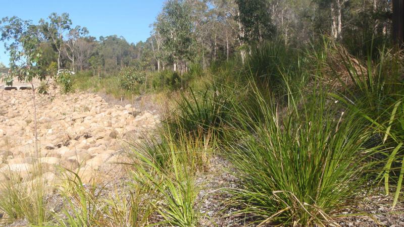
Stormwater planning and design must consider existing natural flow paths and ensure existing vegetation is adequately considered, for example:
- if the existing vegetation in an open space, traditionally seeks wet feet; all future design works for that location must maintain a similar environment to ensure the natural vegetation is not impacted upon. New infrastructure must compliment the natural ecology of the site.
Integration provides:
- recreational value
- visual amenity
- improved functionality
- nature - increased habitat value
- improved stormwater quality and quantity outcomes (including water harvesting)
- improved overland flow conveyance
- compliance with minimum Desired Standards of Service (DSS) presented in the ELS. This ensures the desired role and function of each open space category can be achieved (i.e. provision rate, size, shape, road frontage, flood immunity).
- New stormwater infrastructure may only be considered acceptable, where there is an increased functionality of the open space.
- It is preferred that stormwater quality infrastructure such as GPTs, streetscape raingardens, gully pit (including baskets), passive irrigation for street trees, etc., are located within road reserve, rather than in the open space.
- In the instance where a portion of a recreation park or environmental reserve contains existing stormwater function, there are various ways in which new stormwater infrastructure can complement and improve the use of the site, without reducing the primary intended use or functional area. Introduction of new stormwater infrastructure must be considered on a site by site basis.
The following positioning solution methods (case studies) are designed to maintain and or enhance the function of the site.
Case studies
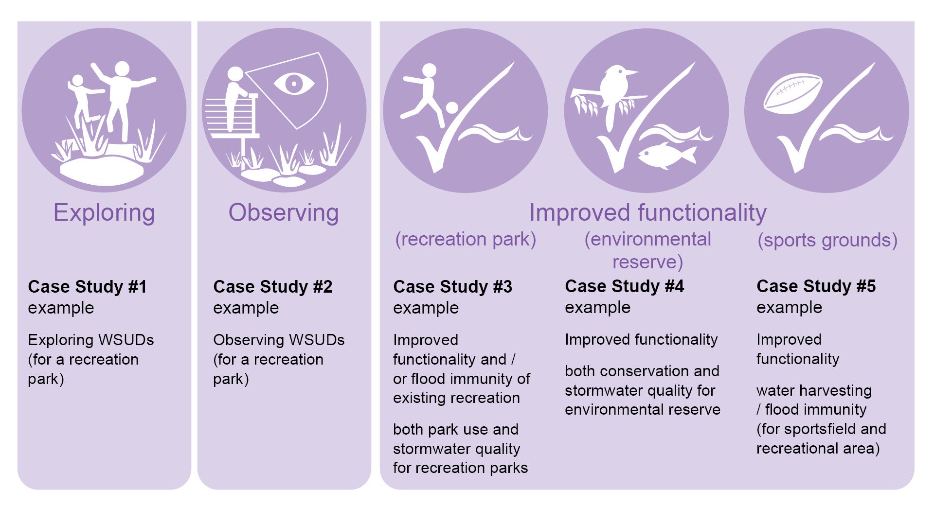
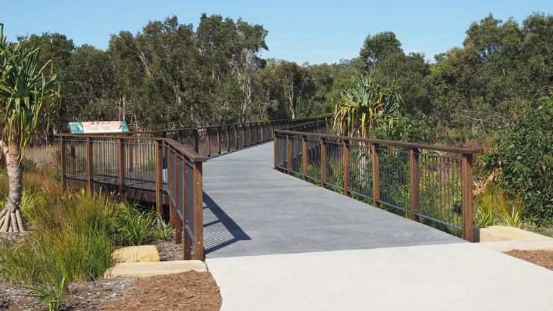
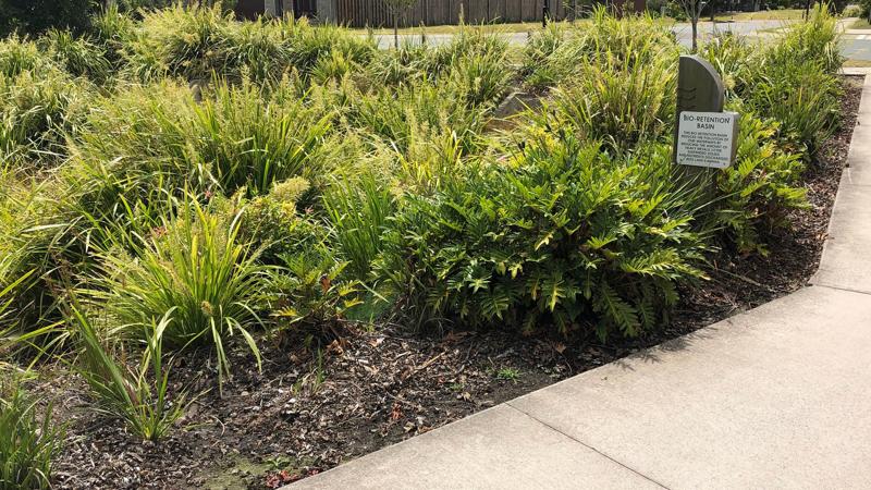
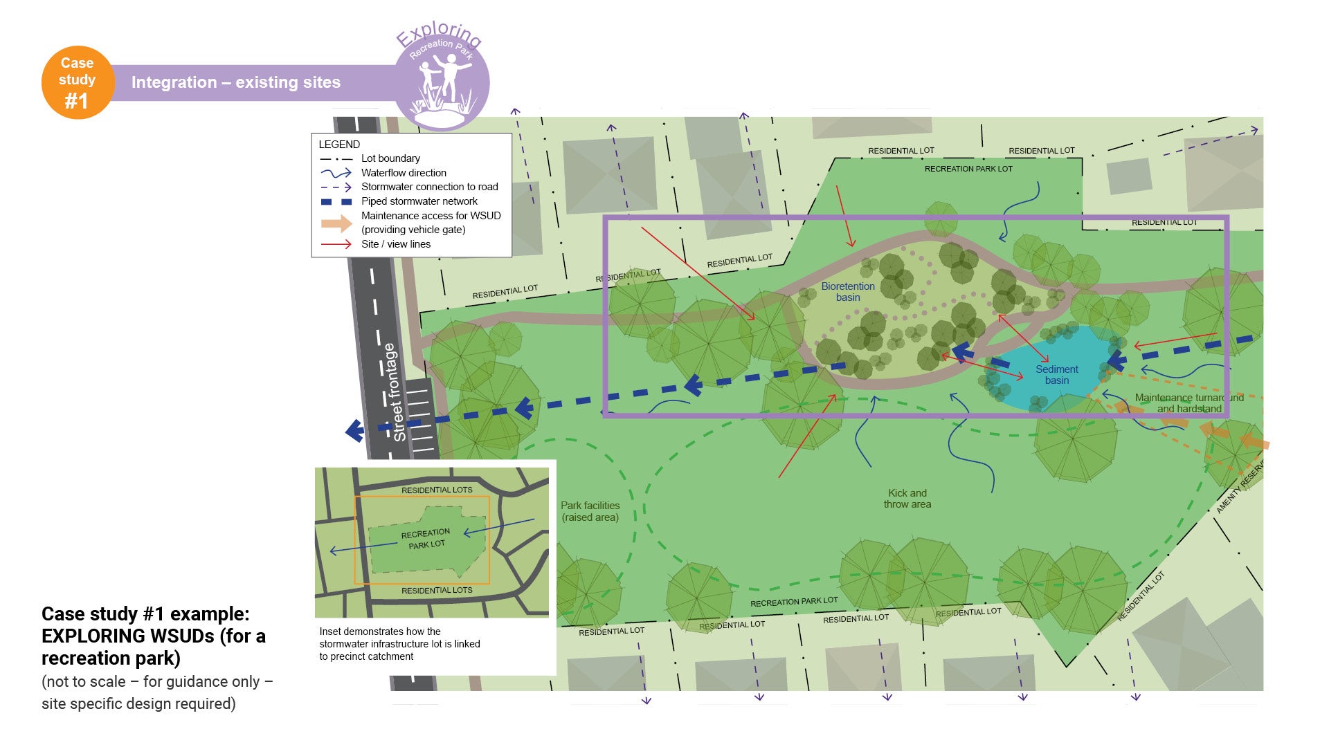
Case study #1 - Integration - existing sites (exploring)

Exploring WSUDs (for a recreation park)
This case study demonstrates how a recreation park can successfully integrate WSUD components, thus contributing to the overall recreation function. Features include:
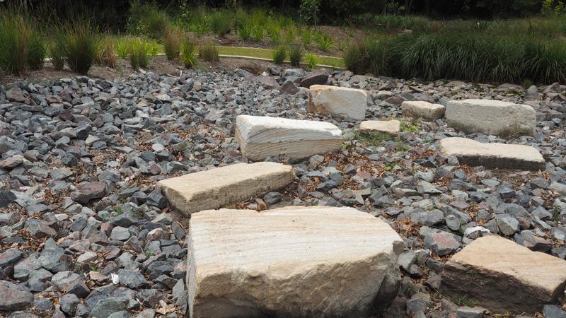
- The bio-retention basin can include pathways, educational signage and seating nodes throughout the design, to enable users to participate and interact
- Meandering pathways and well positioned stepping stones can provide opportunities to explore the landscape.
See Figure 20: Case study #1 example: EXPLORING WSUDs (for a recreation park).
Key elements for recreation parks
Exploration
Learning self movement and body position / balance experiences through smell, touch, hearing, sight.
Linkages
Creating pedestrian/cycle networks (active transport opportunity), accessibility, connectivity, health and well-being benefits.
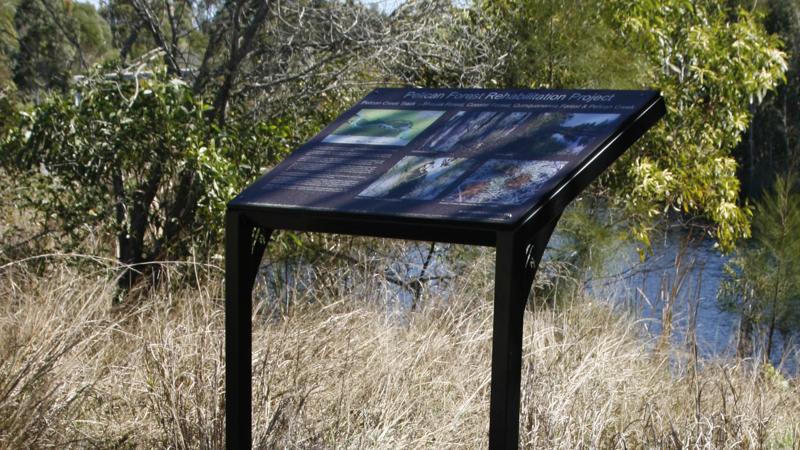
Education
Interpretive signage displaying environment, WSUD functions and site characteristics, cultural heritage.
Environmental sustainability
Connecting actions to the land, waterwise, pollutants.
Figure 20: Case study #1 example: EXPLORING WSUDs (for a recreation park)
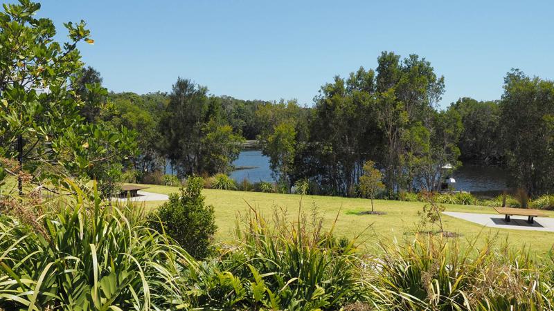
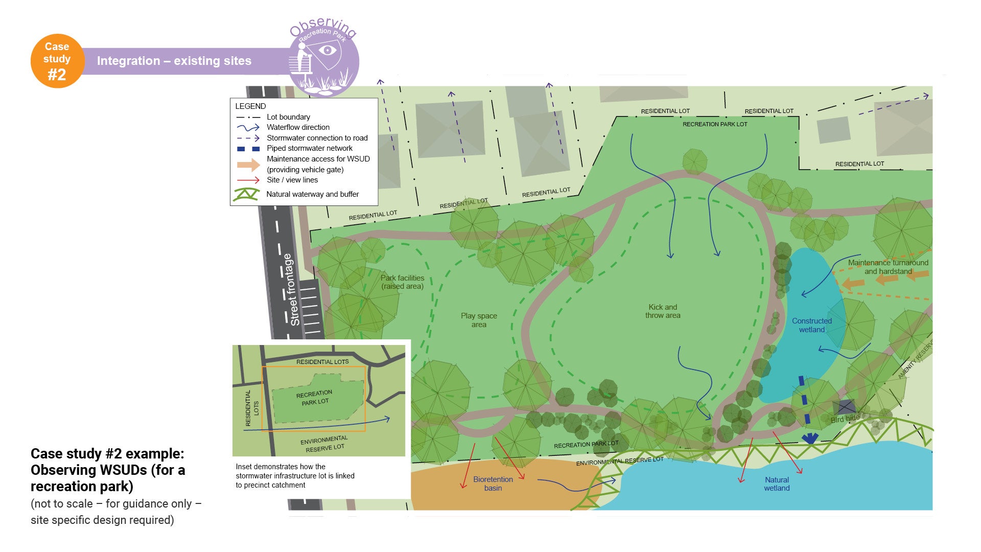
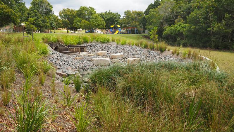
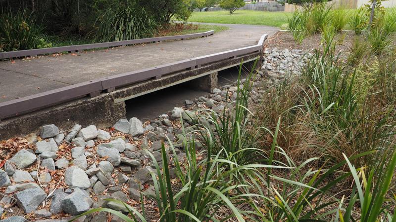
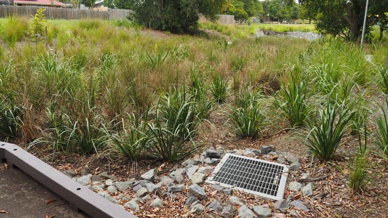
Case study #2 - Integration - existing sites (observing)

Observing WSUDs (for a recreation park)
This case study demonstrates how a recreation park can successfully integrate WSUD components, thus contributing to the overall recreation function. Features include:
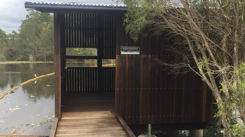
- The constructed wetland can incorporate pathways along the waters edge, with shaded rest points, promoting the borrowed landscape. This can be further enhanced with viewing platforms and where significant bird populations exist, birdhides
- Educational signage can promote public awareness of environmental sustainability and WSUD functions
- Thick planting and well designed batters transitioning into waterbodies, are just some of the design solutions that can increase safety and remove the need for fencing, thus providing barrier free vistas
- These vistas provide the opportunity to incorporate the 'borrowed landscape', making the space seem more expansive than it actually is.
See Figure 21: Case study #2 example: Observing WSUDs (for a recreation park).
Key elements for recreation parks
Borrowed landscape
Reduced fencing, barrier free vistas.
Nature appreciation
Bird watching and discovery of flora and fauna
Batter design
Thick planting and well designed batters into waterbodies, safety, remove need for fencing, over hanging trees providing shading and weed.
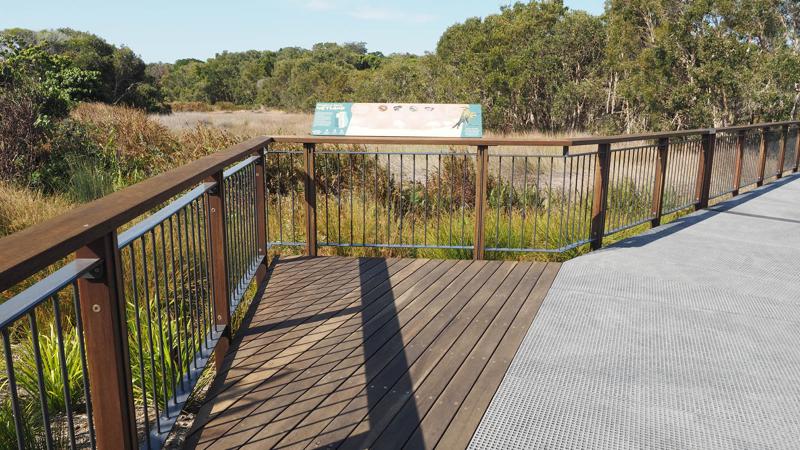
Educational
Interpretive signage displaying environment, WSUD functions and site characteristics. Seasonal patterns, weather changes, cultural heritage.
Figure 21: Case study #2 example: Observing WSUDs (for a recreation park)
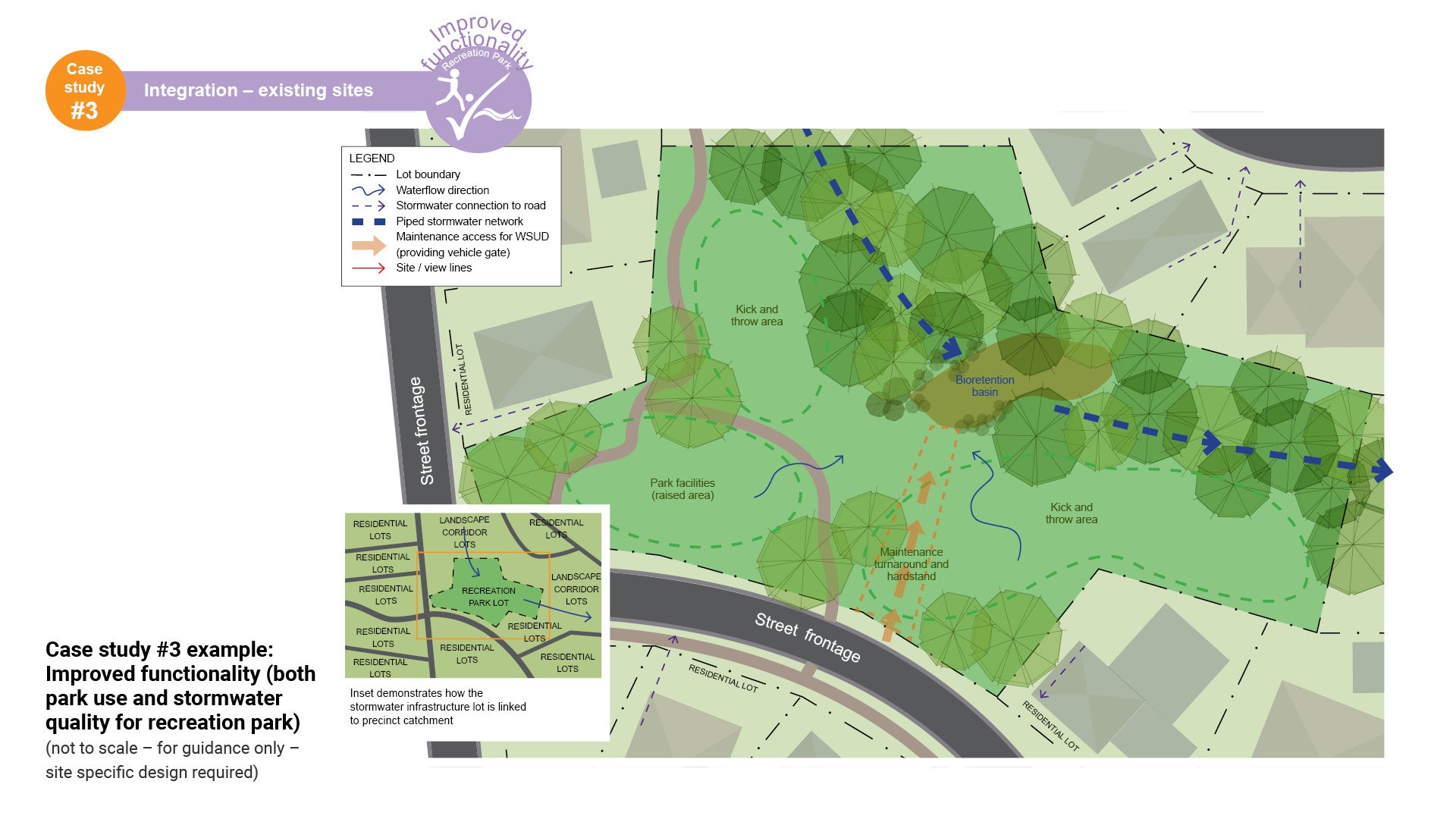
Case study #3 - Integration - existing sites (improved functionality)

Improved functionality (both park use and stormwater quality for recreation parks)
This case study demonstrates how successfully integrating WSUD can help improve park functionality for a recreation park. Good design will ensure both the recreational capacity of the park and the stormwater quality are equally improved. Features include:
- Improved functionality/quantity of stormwater, (i.e. utilising water logged areas for stormwater quality initiatives)
- Improved stormwater quality
- these in turn, assist with fixing other adjoining recreational park functions (i.e. play spaces, kick and throw areas), thus making them more functional. Play areas may be raised to improve flood immunity
- All of these improvements assist with the overall amenity of the park.
See Figure 22: Case study #3 example: Improved functionality (both park use and stormwater quality for recreation park).
Key elements for recreation parks
Separating functions
Creating usable spaces, controlling water flow.
Usability
Creating pedestrian access through inundated areas.
Stormwater quality
Improved; quality, habitat, amenity, aesthetics, and community ownership.
Flood immunity
Ensure no loss of flood storage when seeking to improve flood immunity. Achieve cut and fill balance (use onsite soils where suitable), provide good drainage.
Figure 22: Case study #3 example: Improved functionality (both park use and stormwater quality for recreation park).
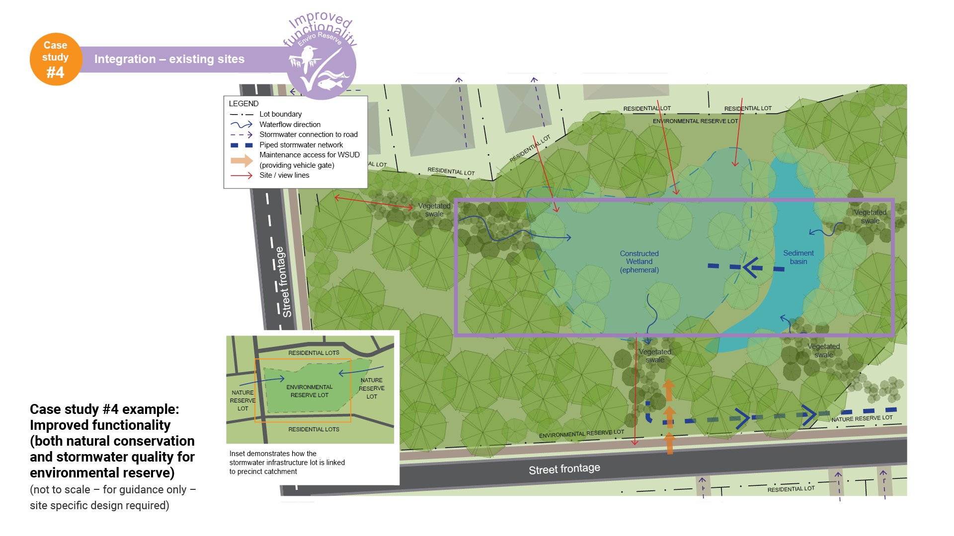
Case study #4 - Integration - existing sites (improved functionality)

Improved functionality (both conservation and stormwater quality for environmental reserve)
This case study demonstrates how successfully integrating WSUD can help improve reserve functionality for an environmental reserve. Good design will ensure both the recreation/conservation capacity of the park and the stormwater quality are equitably improved. Features include:
- Improved flora/fauna habitat and linkages
- Improved functionality/quantity of stormwater, (i.e. improving waterlogged areas)
- Improved stormwater quality
- Increased awareness and encouraging stewardship of the land
- All of these improvements assist with the overall amenity of the reserve.
See Figure 23: Case study #4 example: Improved functionality (both natural conservation and stormwater quality for environmental reserve).
Key elements for environmental reserves
Usability and access
Creating pedestrian and cyclist access through inundated areas.
Increasing awareness
Encouraging stewardship, connecting behaviours to the environment, waterwise, pollutants, education – seasonal patterns, weather changes, cultural heritage.
Stormwater quality
Improved; quality, habitat, ecology, riparian zone and habitat connectivity.
Improved amenity
Recreational/conservation capacity improved.
Figure 23: Case study #4 example: Improved functionality (both natural conservation and stormwater quality for environmental reserve)
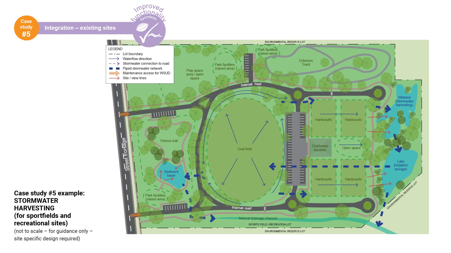
Case study #5 - Integration - existing sites (improved functionality)

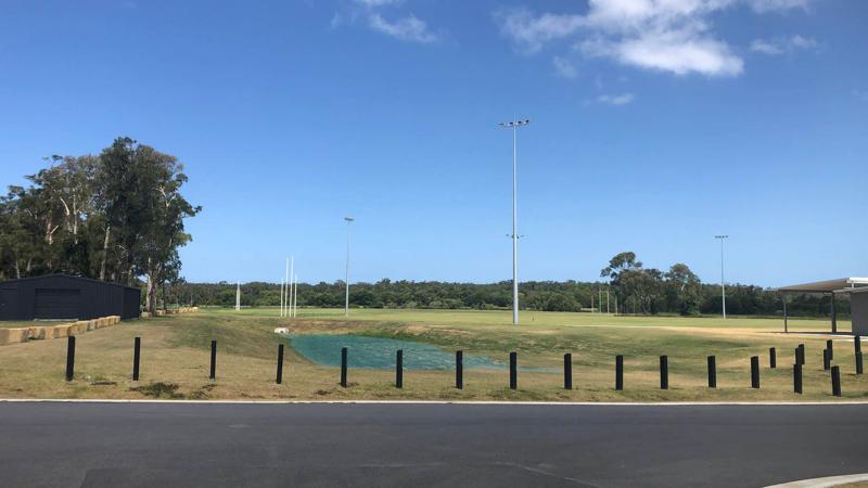
Stormwater harvesting and floodwater immunity (for sportsfields)
This case study demonstrates how sportsfields and recreational areas can successfully integrate water harvesting, thus contributing to the overall recreation function. Features include:
- Collecting runoff, treating it and storing it in a constructed wetland, sediment basin, or storage tank and then using the water to service the surrounding recreation facilities:
- Irrigation for sportsfields (where suitable)
- Irrigation for shade trees and garden beds (where suitable).
- Access to stormwater creates opportunities to provide shade trees and landscaping around sportsfields for spectators, without the need for potable water.
- Sustainable use of water source.
Note: principles may also be applied to recreational areas.
See Figure 24: Case study #5 example: Stormwater harvesting (for sportfields and recreational sites).
Key elements for sportsfields
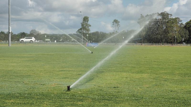
Operational
Irrigation, alternative water source for sportsfields and gardens.
Stormwater storage
Storage point for irrigation supply, delivery to fields, water treatment, reduction in potable water usage, opportunities for recreation (dependant on design).
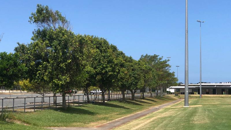
Spectator shade
Improved shade around sportsfields for spectators.
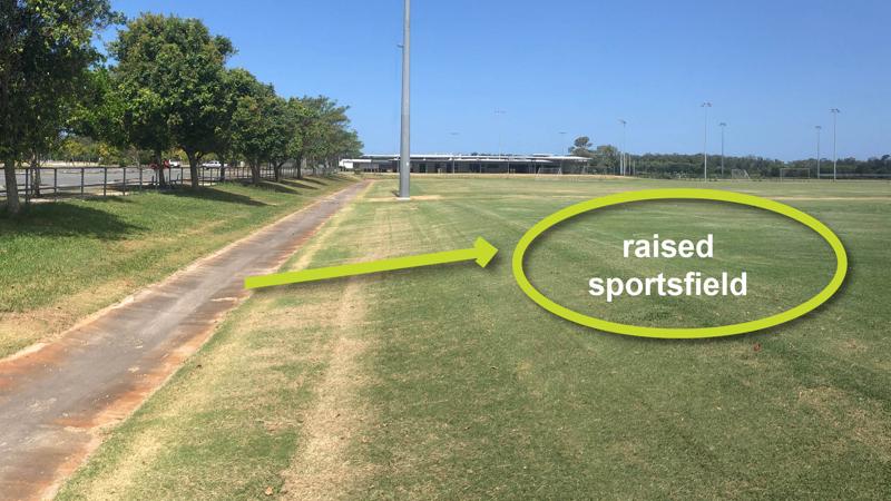
Flood immunity
Ensure no loss of flood storage when seeking to improve flood immunity.
Figure 24: Case study #5 example: STORMWATER HARVESTING (for sportfields and recreational sites)
This component is currently in development