Waterways (watercraft facilities)
Positioning
Best practice guidance for the placement and arrangement of embellishments
Site setout
Purpose
- Avoid interference with natural coastal processes where possible.
- Minimise interference with natural coastal processes where interference is unavoidable.
Orientation
- Position infrastructure for watercraft access to waterways at safe, protected locations.
- Consider all modes of transport to watercraft launching facilities for vehicles and pedestrians.
- Consult with watercraft user groups to identify areas such as temporary storage, setup and pre-launch sites. Incorrect positioning of future infrastructure such as tables/seats may impede or block existing temporary use areas. Any new infrastructure should avoid such areas where possible.
- Provide clearly defined canoe put-in areas to discourage water craft users from selecting other locations which may worsen erosion.
- Ensure that where canoe and kayak launching occurs, this facility does not diminish or detract from the open space and park areas, these functions should be separated.
- Design a designated vehicle access to prevent vehicles from driving through parks and play spaces to launch watercraft as this creates potential conflicts with pedestrians.
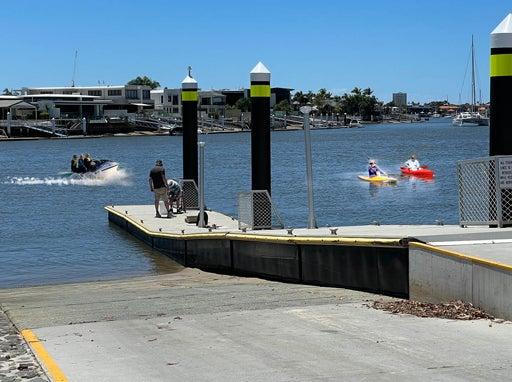
See Figure 8: Watercraft categories.
Links
- Connecting pathways are required for canoe and kayak transfer by people living nearby who use hand powered trolleys to access launching sites.
Safety
- Crime Prevention through Environmental Design (CPTED) principles apply.
Figure 8: Watercraft categories
Preferred layouts for watercraft launching facilities
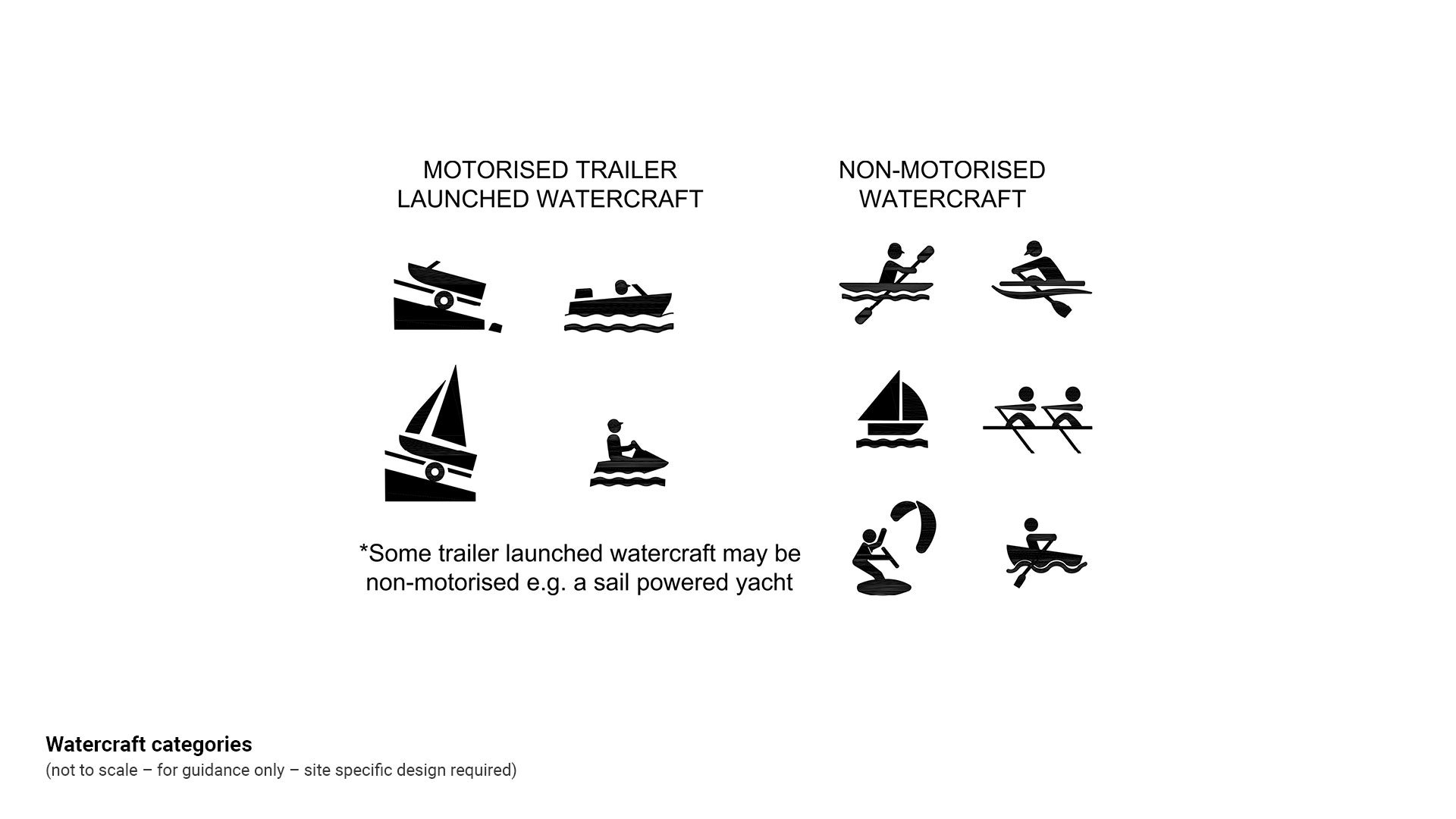
When positioning recreational watercraft launching facilities, the preferred design layout, is separated locations:
- Non-motorised (human powered) facilities and trailer launched watercraft ramps are totally separated and at different locations.
When designing separated recreational watercraft launching facilities, consider the following:
- A distinct site separation of use is desirable in order to protect areas such as parks and open spaces and to protect pedestrian activity.
- Where non-motorised craft are launched ensure, the activity does not detract from the amenity of any open space/park area that may be nearby as:
- vehicles may be tempted to drive through a park to launch watercraft.
- safety at facilities such as playgrounds could be compromised by vehicle movements.
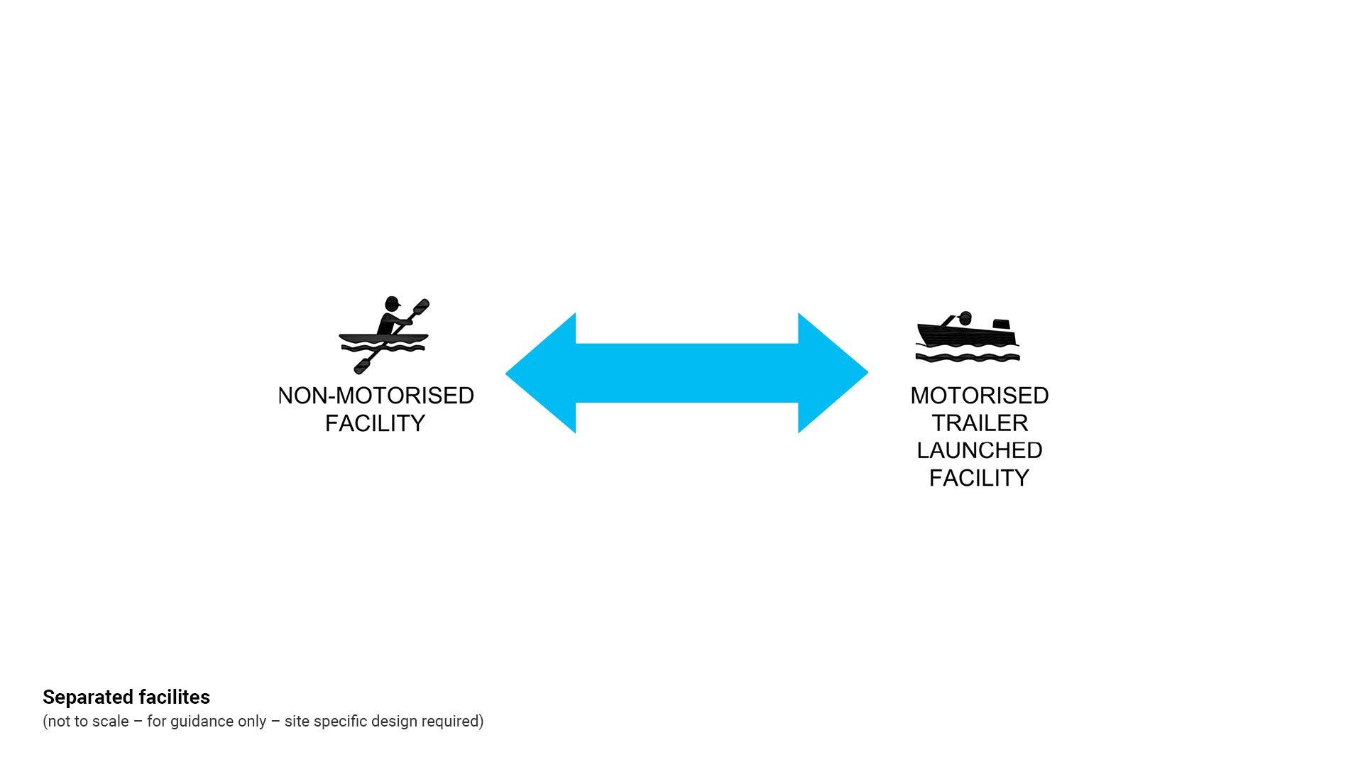
When positioning recreational watercraft launching facilities (and totally separated sites are not possible), the second preferred design layout, is co-located facilities:
- Non-motorised (human powered) facilities and trailer launched watercraft ramps have distinct facilities but operate side by side, at one location.
When designing co-located recreational watercraft facilities, consider the following:
- Where facilities are co-located (side by side), provide maximum separation. See Figure 9:Typical co-located (side by side) watercraft facilities.
- Install the following to delineate trailer launched and non-motorised watercraft areas:
- Signs clearly designating different activity areas. Where rigging/de-rigging/unloading areas are shared between motorised and non-motorised activities, include signage that specifies both activity users can use this space, so there is not preference for either.
- Line marking and signage clearly designating preparation areas such as rigging/de-rigging/unloading and other short-term activity areas such as wash down sites.
All watercraft facilities
- Install all required regulatory and information Transport and Main Roads boat ramp signage such as ‘Public Boat Ramp’ , ‘Load Limit’ and ‘Overhead Wires’ (where required).
- Locate signs where they could reasonably be expected to be visible to ramp users.
- For water installed signage such as buoys use environmentally friendly moorings, not block and tackle moorings which rip out seagrass beds.
- To minimise impacts on sensitive shoreline environments, construct well defined and safe pedestrian pathway connections from car parking to launch areas.
- Provide clearly defined portage pathways and canoe launch (put-in) areas to discourage craft from being launched, retrieved or beached other than at designated areas. Establish a designated launching site to protect coastal and river environments from erosion.
- Connecting pathways are required for canoe and kayak transfer by people living nearby who use hand powered trolleys to access launching sites.
- Locate all associated embellishments such as car parking as close as possible to watercraft facilities.
- Where space is available, provide a vehicle queueing area beside/near to the boat ramp and in addition to the preparation areas.
- Provide a queueing beach beside the boat ramp, to allow temporary boat parking prior to access of the ramp. A queueing beach allows for watercraft to temporarily anchor on the beach (beside the ramp), to allow users to park / retrieve their vehicle and trailer.
- Queuing beach to be separate from the non-motorised beach access point where possible.
Typical design for co-located watercraft launching facilities at one location:
Co-locate non-motorised and trailer launched watercraft facilities side by side at one location.
- Combination watercraft facilities provide an opportunity for the shared use of associated embellishments.
- Non-motorised and trailer launched facilities are to have clearly identified, separated activity areas. Provide maximum possible separation to avoid conflict of use.
- Long term car parking may be shared
- Short term car parking provides for specific activities associated with the type of watercraft, such as a rigging/de-rigging area for yachts and motor boats.
- A connection pathway provides safe pedestrian movement and minimises pedestrian and vehicle conflicts.
See Figure 9: Typical co-located (side by side) watercraft facilities.
Figure 9: Typical co-located (side by side) watercraft facilities

Clearances
Pontoons
Pontoons must be constructed to allow for maximum tidal changes so they do not present dangerous access options.
- A registered professional engineer Queensland (RPEQ) is required to provide specifications for tidal structure to ensure the design incorporates maximum tidal changes.
Boat ramps
- To calculate design HAT and LAT refer to Queensland Tide Tables (current edition).
See Table 4: Clearances for further guidance.
Table 4: Clearances
Embellishment | Distance from | Minimum distance | Reason |
Boat ramp head | highest astronomical tide (HAT) | +0.5 m | The facility is usable across the full tidal range. |
stairs | as close as possible | Install stairs in adjacent seawall for pedestrian water access. | |
Boat ramp toe | lowest astronomical tide (LAT) | -0.5 m | The facility is usable across the full tidal range. |
Boat ramp | clear area to any other land based embellishment | 2.5 m | For deck mower clearance (where possible). Avoid creating small, difficult to mow areas. |
This component is currently in development