Waterways (watercraft facilities)
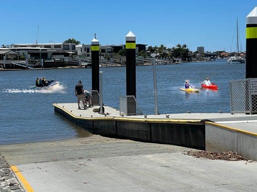
Site planning
Best practice guidance for site planning
Decision framework
Coastal Hazard Adaptation Strategy
Council’s strategic direction to manage the impacts of coastal hazards, is outlined in the Council's Coastal Hazard Adaptation Strategy.

Shoreline Erosion Management Plan (SEMP)
The Shoreline Erosion Management Plan (SEMP) addresses priority erosion issues at specific locations and recommends preferred management options that are underpinned by sound science, coastal engineering principles and community values. Also refer to specific Council Lake and Canal Management Plans which have been prepared for each constructed coastal lake currently managed and maintained by council. All watercraft infrastructure must be located, designed and constructed in accordance with identified coastal hazards. Refer to the Coastal Protection and Management Act 1995 and the State Development Assessment Provisions – Module 10: Coastal protection and State Code 8: Coastal development and tidal works. There are a range of Australian Standards/best practice guidelines, relating to this category. Key documents are referenced throughout and in the LIM Waterways (watercradt facilities) - Standards.
Shoreline Erosion Management Plan 2025-35.jpg
47.72 kB
image/jpeg
Site decisions
All decisions, including the location of the embellishment and related infrastructure, must be made in conjunction with council (determined by site location), including officers from such areas as:
- Council (Parks and Gardens)
- Council (Environmental Operations)
- Council (Transport Network Management)
Note: It is preferred that new watercraft facilities are located within or alongside existing recreational parks where possible.
Users
Consult with council stakeholders, neighbouring properties and identified park users in the planning stage of a project.
- Consult with watercraft user groups to identify areas such as temporary storage/setup/pre-launch sites. Incorrect positioning of future infrastructure such as tables/seats may impede or block existing temporary use areas. Any new infrastructure should avoid such areas where possible.
Site conditions
Facilities are to be designed and constructed to ensure they are structurally sound and have regard to the impacts of flooding and hydrodynamic changes.
- Consider flood debris impacts on new and existing embellishments when designing watercraft infrastructure.
Consider the physical characteristics of a site and requirements of the activities to be conducted:
- location of utilities.
Co-location of facilities
All new watercraft launch facilities should be located near existing recreation park facilities, where possible to enhance the use of recreation parks and to ensure the following:
- Facilities, including parking and pathways, are often already established and need to be considered in the overall park design.
- People participating in water based activities have access to supporting infrastructure such as water, toilets and car parks.
- Where it is not possible to locate new facilities near existing recreational parks, the new infrastructure should be located along a recreation trail.
- Consider that easy access to a waterbody is critical for undertaking maintenance activities such as sediment removal or weed control.
- Include connecting pathways for universal access.
Safety
- Safety clearances must be met.
- Adopt principles of Crime Prevention Through Environmental Design (CPTED) Guidelines for Queensland. Locate watercraft facilities to allow users to feel safe, and to provide an opportunity for casual surveillance.
Potential site conflicts
- Consider watercraft facility proximity to residential properties. Boat users/fishermen seek optimum fish feeding times which can be early morning and may disturb the quiet enjoyment of nearby residential property. Refer to Environmental Protection (Noise) Policy 1997 for further guidance.
- Works are to be located clear of any existing stormwater outlet.
- Consider the Tobacco and Other Smoking Products Act 1998 and regulations. Smoking is prohibited at:
- public swimming facilities such as swimming pools and associated areas
- between the flags on a patrolled beach
- at some artificial beaches between sunrise and sunset
- within 5.0 metres of a ferry terminal.
- Smoking related infrastructure such as outdoor ashtrays are to be designed outside the required anti-smoking offsets.
Planning for sustainability
Refer Design principles – Sustainability for guidance.
Planning for future works
- Co-locate embellishments requiring similar services e.g. water, to reduce infrastructure, where possible.
- Where underground utilities are installed, set brass markers to concrete slab edges to indicate the location.
- Consider installation of additional conduits under concrete slabs for future provision, where utilities (e.g. electrical, water) and irrigation systems are planned. Ensure additional conduit is capped to prevent ingress of water and debris.
- Consider climate change impacts on the embellishment location and construction 1.
- In coastal areas, or near waterways, design should consider rise in sea level predictions, storm tide, salt inundation and severe storm events.
- Positioning should also consider flooding, seasonal/ephemeral water bodies and water table changes.
- Near bushland areas, design should consider the occurrence of bushfires.
Source 1: Sunshine Coast Environment and Liveability Strategy 2017.
Preliminary considerations
Waterbody management
Waterbodies are visible bodies of surface water, such as lakes, streams, estuaries and canals. They are an important part of our landscape and have environmental, economic, social and recreational value.
The design and placement of watercraft launching and water based recreational access facilities should be undertaken in a way that does not alter natural erosion and accretion processes or cause erosion problems in neighbouring areas.
- Some recreational activities that occur in waterbodies include:
- swimming
- fishing
- kayaking
- kite surfing
- boating and other activities.
- Suitable recreational space and facilities are required to support these activities.
- Waterbodies play important hydraulic and hydrologic roles within stormwater and broader waterway network catchment.
- Waterbodies and wetland systems as classified by the Queensland state classification of wetlands and include:
- Natural waterbody with no modifications to its water flow.
- May have been naturally present but has since had its water flows modified.
- Is totally artificial and was never previously present in the landscape.
- Sunshine Coast’s streams and estuaries are assessed under the Ecosystem Health Monitoring Program (EHMP) that is coordinated by Healthy Land and Water. Council also undertakes water quality monitoring in priority waterways.
- In addition, the Waterwatch Program operates as a community based network of local volunteers who test the water quality of local creeks and gather data for council.
- Maintenance of natural coastal processes is synonymous with waterbody management. It supports, State and Council policy positions on erosion (specifically Council's Coastal Management Policy: 7.3.1 ‘Community infrastructure that supports social and recreational use, is planned and developed to protect and enhance coastal values’).
- Weathering and the erosion, transport and accretion of sediments is very important, as are other outcomes of waves, surges and water level variations - specifically inundation. Ecological and bio-chemical processes are also important processes.
- Infrastructure design must take into account the issues and interests of waterway and land users, environmental impacts, safety, general amenity, as well as the enforceability of regulations.
See the following for further guidance:
- LIM Water sensitive urban design (WSUD)
- Waterbody Management Guideline Overview 2013 by Water by Design.
Preliminaries investigations
The ultimate selection of a waterway structure’s components depends primarily on-site tests such as:
- Land survey
- Hydrographic survey
- Acid sulfate soils test
- Geotechnical survey.
Land survey
Land surveying is the spatial science of measuring and mapping of the surrounding environment and boundaries of a site.
- The survey data provides detail to determine contours, and natural and artificial features to guide engineers and designers.
- Engage a surveyor registered in Queensland to undertake a land survey.
Hydrographic survey
Hydrographic survey is the specialist science of measurement and description of features which affect maritime navigation, marine construction and related activities.
- Measurement of depth and features below water level is used typically for detection of underwater obstructions and the shape of beds and banks for engineering design and construction.
- Engage a surveyor registered to international standards with the Australasian Hydrographic Certification Panel (AHSCP).
Acid sulfate soils test
Acid sulfate soils (ASS) can occur along the Queensland coastline.
- ASS can occur inland.
- Tests are to be undertaken for the assessment of the likelihood of acid sulfate soils, to determine the liming rate or management strategy.
- For treatment methods see Queensland Acid Sulfate Soil Technical Manual – Soil Management Guidelines version 3.8.
- For investigation and management plans engage a Certified Professional Soil Scientist (CPSS) experienced with ASS.
Geotechnical survey
Below ground investigations by boring, sampling and testing to obtain information about the physical properties of soil and rock at a site.
- Test results include soil compressibility, strength and other characteristics likely to influence a construction project.
- Geotechnical (soil test) results indicate the potential for structural instability. Transport and Main Roads – Design Criteria for Boat Ramps assumes stable conditions.
- Engage a Registered Professional Engineer in Queensland (RPEQ) geotechnical engineer.
This component is currently in development