Fences and gates
Site planning
Best practice guidance for site planning
Decision framework
There are a range of Australian Standards/best practice guidelines, relating to this category. Key documents are referenced throughout and in the LIM Fences and gates - Standards.
Clear zone requirements
Road clear zone requirements are to be considered as per Transport and Main Roads Road Planning Design Manual:
- Clear zones are to be free of non-frangible objects.
- Fences and gate materials must not create a spearing hazard if impacted by a vehicle.
Site decisions
All decisions, including the location of the embellishment and related infrastructure, must be made in conjunction with council (determined by site location), including officers from such areas as:
- Council (Parks and Gardens)
Users
Consult with council stakeholders, neighbouring properties and identified park users in the planning stage of a project.
Site conditions
Consider the physical characteristics of a site and requirements of the activities to be conducted:
- location of utilities
- flood immunity requirements.
Existing uses (i.e. events, recreational use)
The design must not impede or prevent existing uses.
Consider the following:
- Recreational uses – Circulation for recreational uses such as:
- watercraft activities unloading and launching
- play space user circulation between equipment and fences.
- Events use – Access for events, such as regular events (festivals) and infrequent events or activities (weddings).
- Council locking systems are temporarily replaced with special event locking mechanisms.
- Community volunteers hold a special key for the duration of an event.
- Must consider safe operation for use by community volunteers.
Wildlife
Consider the movements of wildlife. Design the fence so that it does not create a barrier to wildlife (such as koalas) or to seasonal wildlife (such as nesting turtles).
- The design should not impact adversely on wildlife.
- Design fences to keep native wildlife out of danger zones (i.e. road corridors, housing estates).
- Do not select barbed wire for fences as it poses a significant risk of entanglement and death for wildlife.
See Environmental Reserves – Fauna Fencing for further guidance.
Trees
For fences and gates construction near established trees, refer to AS 4970:2009 Protection of trees on development sites. Consult a qualified arborist to determine:
- Tree protection zones
- Construction offsets
- Where there is a potential for tree root impacts, use tree safe techniques such as vacuum excavation.
See LIM Site set up (including Tree protection) for further guidance.
Co-location of facilities
- Facilities, including parking and pathways, are often already established and need to be considered in the determination of fence and gate location.
Safety
- Safety clearances must be met.
- Adopt principles of Crime Prevention Through Environmental Design (CPTED) Guidelines for Queensland. Locate fences and gates to allow users to feel safe, and to provide an opportunity for casual surveillance.
- Facilitate natural surveillance by people within an area.
- Enable overlooking by retaining line of sight for people outside of the public place.
- Fences are to be visually and climatically permeable.
Potential site conflicts
Locate fences and gates away from:
- High use bikeways, busy roads and steep slopes, to avoid accidents.
- Avoid interfering with other open space users. Fences and gates installed too close to the edge of pathways will interrupt the free flow of pedestrian/cyclist traffic.
- Hazards such as waterways, fire and flood prone areas, sewers and stormwater drains, underground services.
Overland flow
When installing fences to protect environmental reserves and open spaces where there is an overland flow path, a rural type standard fence must be installed. The fence must have adequate spacing of chain wire or wire / timber rails to limit the amount of debris build up and to ensure the overland flow path remains unobstructed.
Consider the following:
- Avoid fencing an overland flow path (where possible).
- The selective placement of fencing is governed by the Queensland Urban Drainage Manual (QUDM) and Council Local Law 3: (Community Health and Environmental Management) 2011 (Part 5 Community safety hazards).
- The Local Law 3 states a community safety hazard is:
- Works that have restricted or redirected the flow of stormwater over land in a way this is likely to cause the water to collect and to:
- become stagnant, or
- cause damage to the environment, property or infrastructure, or
- cause harm or injury to a person or animal.
- Works that have restricted or redirected the flow of stormwater over land in a way this is likely to cause the water to collect and to:
Fence design to prevent flood damage
Where there is a need to fence an area that experiences flooding, erect a rural type timber post and wire fence with the following design inclusions:
- Where possible reduce fence resistance to flood waters by constructing up-slope from the lowest point of an overland flow path.
- Construct the fence at right angles to the direction of flow to reduce damage.
- Increase fence post resistance to overturning by:
- positioning posts closer together per length of fence to provide a greater resistance to flow and,
- ensuring posts are set deep and well secured to ensure they are less likely to be pushed over in a flood event.
- desirable post positioning is to the high sides of an overland flow path, not in the centre of the depression.
- Timber posts with a large cross sectional area have a greater resistance to overturning in wet ground.
- Timber posts with a larger below ground surface area, increase contact with the soil.
- Maintain wire tension to promote vibration, which assists in reducing debris load.
- Construct fences with less vertical height (where possible). The taller the fence the less stable it becomes during flood events
Note: Fences across an overland flow path are generally not supported.
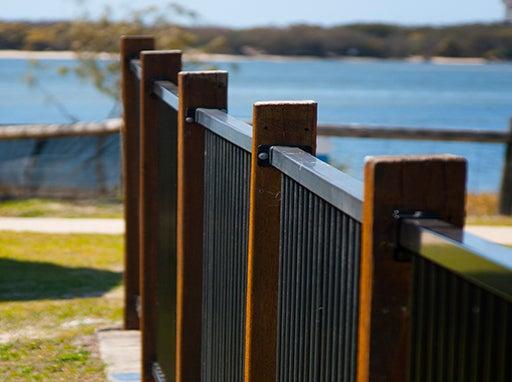
Coastal management
The environment must be considered and protected before any development or construction is undertaken. Consider that:
- an appropriate barrier treatment may assist to minimise negative impacts on the coastal environment.
- fences near beaches should be planned and designed to protect the surrounding environment whilst providing a safe path of travel for pedestrians.
- fences near beaches must be designed to consider seasonal pathways for marine animals such as turtles (See LIM Beach infrastructure).
The Sunshine Coast has over one hundred kilometres of coastal foreshores which council manages. Council has developed a coastal planning and management framework that delivers policy and planning tools to support protection and sustainable use of our beaches, headlands and estuaries.
- These environments are highly valued for their cultural, ecological and recreational functions.
- Unless carefully designed and constructed, infrastructure in and adjacent to waterbodies can exacerbate erosion issues.
- The Shoreline Erosion Management Plan (SEMP) provides an action plan that describes coastal processes and identifies council controlled assets exposed to erosion threats.
See the following LIM categories for further guidance:
Planning for sustainability
Refer Design principles – Sustainability for guidance.
Planning for future works
- Co-locate embellishments requiring similar services e.g. water, to reduce infrastructure, where possible.
- Where underground utilities are installed, set brass markers to concrete slab edges to indicate the location.
- Consider installation of additional conduits under concrete slabs for future provision, where utilities (e.g. electrical, water) and irrigation systems are planned. Ensure additional conduit is capped to prevent ingress of water and debris.
- Consider climate change impacts on the embellishment location and construction 1.
- In coastal areas, or near waterways, design should consider rise in sea level predictions, storm tide, salt inundation and severe storm events.
- Positioning should also consider flooding, seasonal/ephemeral water bodies and water table changes.
- Near bushland areas, design should consider the occurrence of bushfires.
Source 1: Sunshine Coast Environment and Liveability Strategy 2017.
This component is currently in development