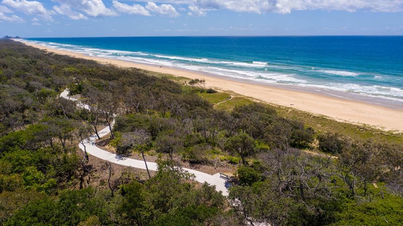
Paths, trails and tracks

Recreation planning
Best practice guidance for recreational planning of paths, trails and tracks.
Planning for recreation paths/trails
The Sunshine Coast Recreation Trails Plan 2012 outlines the key elements used in the assessment and planning of recreation paths/trails, they are as follows:
- trail supply – adequate provision and equitable distribution.
- range and diversity – is able to be assessed for each user type using the following elements:
- catchment – local, Sunshine Coast wide or regional.
- category – length of the trail is short, medium or long.
- level of difficulty – is different to each user group.
- trail capacity – relates to the provision of single, shared or multi-use trails.
- quality – alignment, length, surface and supporting infrastructure.
Supporting infrastructure includes embellishments such as trail signage, interpretative signage, car parking, seating and picnic facilities.
Land tenure and path/trail location siting
Land tenure
The alignment of a path/trail may traverse through various parcels of land which are controlled by various land managers (e.g. adjoining landholders, state controlled land or council controlled land). See Figure 1: Example – path/trail siting with various land managers.
Figure 1: Example – path/trail siting with various land managers
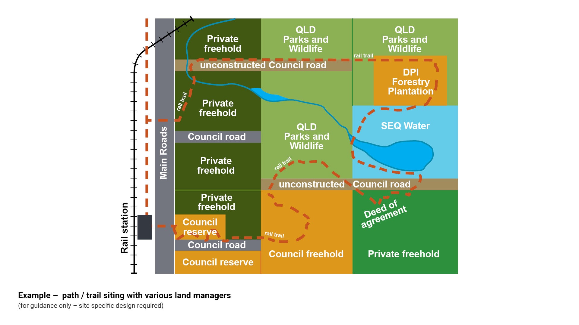
Source: Draft South East Queensland active trails implementation guideline.
The following are key considerations:
Adjoining landholders
- When designing paths/trails alignment consider if a pre-existing lease or agistment arrangement is in place. Consider stock management and access e.g. install self-closing stock gates and stock grids to reduce the path/trail impact on adjoining landholders.
- Design buffer zones to mitigate potential path/trail impacts. Install screening vegetation to address privacy concerns for adjoining residential dwellings.
- Ensure adequate setbacks are provided to existing vegetation on private land.
- Where conflicting use of the land is not able to be resolved, consider diversion of the path/trail to another location.
State controlled land
- Permits are required for works on or near State controlled land and roads and on or near water courses. See to the controlling State authority for permit requirements and guidelines such as:
- Queensland Parks and Wildlife (National Parks Sport Recreation and Racing Queensland)
- Transport and Main Roads (The State Road Network of Queensland).
Council controlled land
- Works on council controlled land and in road reserve requires relevant approval by the appropriate council department such as Council (Parks and Gardens - open spaces and parks), Council (Environmental Operations - natural areas and waterways) and Council (Transport Network Management - council roads).
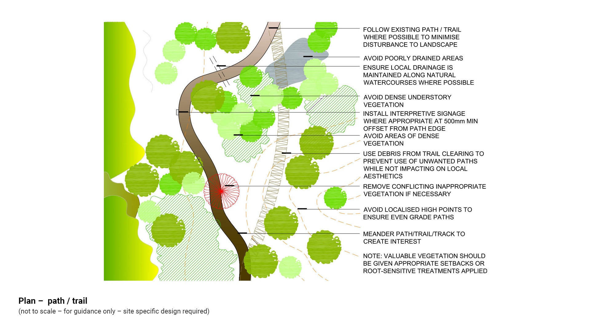
Path/trail/track location siting:
Path/trail/track (PTT) design is critical to providing a good experience for the user and in managing the construction process. Investment of resources in thorough planning and siting of the PTT will minimise initial construction costs and ongoing maintenance costs and impacts.
When siting a new PTT, or updating an existing one, there are a number of important considerations to be reviewed prior to construction. The following principles have been developed to assist in the planning and design process:
- Be aware of who the PTT is planned for – this dictates many of the practical aspects such as slope, width, surfacing, and signage.
- Follow existing PTT where possible to minimise disturbance to the landscape. Careful examination of aerial photography and topographic maps, supported by extensive on-the-ground verification, will help ensure maximal use of already-disturbed locations.
- Consider potential impacts to existing vegetation. Paths should be adequately set back from larger trees and where tree root damage is envisaged, raised or alternative treatments should be explored. See LIM Tree sensitive design (existing and new trees) for further guidance.
- PTT should meander or ‘weave’ across the landscape to take advantage of natural and constructed features and to create interest. Long straight sections should be avoided, as these tend to become boring for the user. The PTT should always engender a sense of ‘I wonder what is around the next corner’.
- Make the PTT interesting by routing it through different vegetation and landforms.
- Locate the PTT near points of interest.
- Consider environmental and cultural values associated with the proposed route. Ensure necessary permits are obtained.
- Avoid poorly drained areas. Ensure local drainage is maintained along natural watercourses where possible.
- Follow natural contours to ensure even PTT grades.
- Avoid areas with high erosion and landslip potential.
- Ensure user safety has been considered.
- Consider the provision of access for service vehicles alongside the PTT to carry out necessary maintenance activities, or points where light maintenance vehicles can enter onto the PTT to carry out maintenance. This becomes more important in paths/trails traversing heavily vegetated landscapes.
- Where clearance envelopes are unable to be provided due to existing natural vegetation, evaluate risk for user groups such as cyclists.
- Consider appropriate remedies such as installing warning signs at the approach to start and finish of reduced clearance areas.
- Use debris from trail clearing to define path/trail edges in consultation with Council (Environmental Operations).
- If inappropriate or conflicting vegetation is encountered, consult with qualified arborist before removal.
See Figure 2: Plan - path/trail.
Figure 2: Plan - path/trail
Gradient of the site
Natural site gradient will assist in the determination of the path/trail/track (PTT) classification. Consider all factors such as user catchment type, user statistics and future area potential.
Paths/trails/tracks (PTT) classification
The LIM has adopted the Australian standard for walking tracks to classify paths/trails:
- AS 2156.1 – Walking Tracks Part 1 Classification and signage.
- AS 2156.2 – Walking Tracks Part 2 Infrastructure design.
- PTT classification helps determine the standard of construction and the provision of signage and associated infrastructure.
- The choice of PTT classification should take into account the type of user, the expected number of users and the recreation opportunities provided throughout the PTT network.
- There are a number of PTT construction guidelines, strategies and peak body guidelines in use around Australia.
See Table 4: Summary path/trail relevant standards/legislation for further guidance.
Useful recreational trail references include:
- MBA’s Guide to Building Sweet Singletrack
- Active Trails – a Strategy for Regional Trails in South East Queensland by the Queensland Government and the Council of Mayors 2007
- Guidelines for Trail Planning, Design and Management by local government and Regional Development Australia
- Trail Difficulty Rating System – Horse by Recreation South Australia.
- Professional Trailbuilders Association (PTA)
- American Trails website.
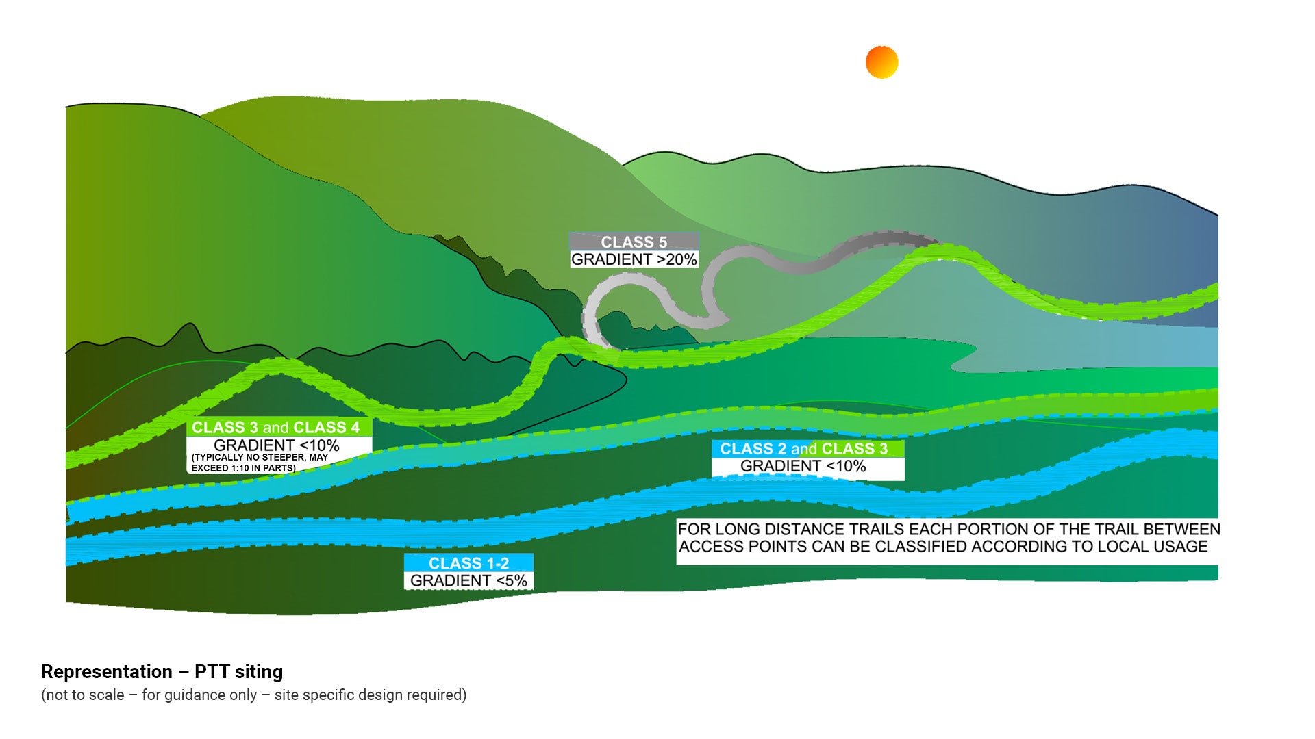
Note: Variation of classification is likely to occur along the length of any PTT. Classify each portion between access points according to usage. See Figure 3: Representation – PTT siting.
Figure 3: Representation – PTT siting
Single/multi-use
Path/trail/track (PTT) capacity design models relate to the provision of a single, shared or multi-use facility and are also guided by the classification of the park or open space.
Single – the PTT is designed predominantly to accommodate one user group.
Shared – the PTT is designed to accommodate more than one user group.
Multi-use – the PTT is designed to accommodate multiple user groups.
The following are typical elements contained within various PTT facilities.
Single use – mountain bike trail/track
Specialist single use mountain bike trails/tracks may contain steep, narrow sections and technically difficult and interesting sections. The nature of the trail should be clearly signed at start and finish to inform users and to discourage inappropriate use.
Single use – bicycle path (off-road)
Off-road bicycle paths include velodromes and criterion paths designed exclusively for cyclists.
Specialist designed bicycle-only paths are classified recreational, commuter or connectivity use. See Austroads Guide to Road Design Part 6A: Paths for walking and cycling. It is important to design an alignment which allows cyclists to travel at a relatively high constant speed (e.g. 30 km/h).
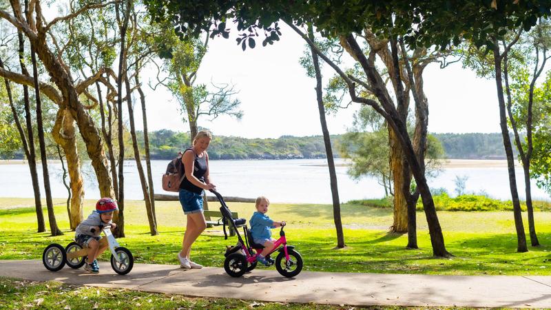
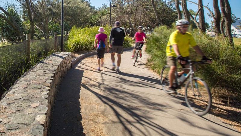
Shared use – walking and cyclist path/trail
Existing data suggests that walkers and cyclists may come into conflict when sharing the same pathway. Cyclists may be unaware that while they are on pedestrian pathways they are subject to the same road rules that are applicable to ‘on road’ bike paths.
Queensland Road Rules allow cyclists to use pedestrian pathways (unless signed ‘no bicycles’), however cyclists must keep to the left and give way to pedestrians.
Significant issues may arise between users including differences in speed, space requirements, age, user expectation and predictability.
Conflict may occur as a result of pedestrians ‘meandering’ across a path/trail or walking in groups which cover the whole width of the path/trail. Cyclists are not always aware that older pedestrians and people with low vision or hearing loss may not hear their approach from behind or that older pedestrians may be startled if a cyclist rings a bell directly behind them, when signaling their approach.
Consider that providing a wider path/trail may encourage cyclists to move at speed. Clear regulatory signage informing both pedestrians and cyclists of their responsibility, should be included at regular intervals along a wider path/trail.
Council generally installs paths/trails which are able to be shared by walkers and cyclists.
Multi-use – walking, cycling and horse riding
When designing a path/trail/track suitable for the requirements of multiple user groups, consider the following:
- The path/trail/track PTT envelope clearance design should target the ‘highest’ needs user group (horses) and consider all user groups.
- In particular, it is unsuitable to provide horse riders with long sections of hard surfaced path / trail or cyclists with long sections of sandy path/trail.
Multi-use with vehicle
- For vehicle access requirements see 6.8 Vehicle users (Austroads classes).
- Multi use PTT with vehicle access such as a fire trail or logging road.
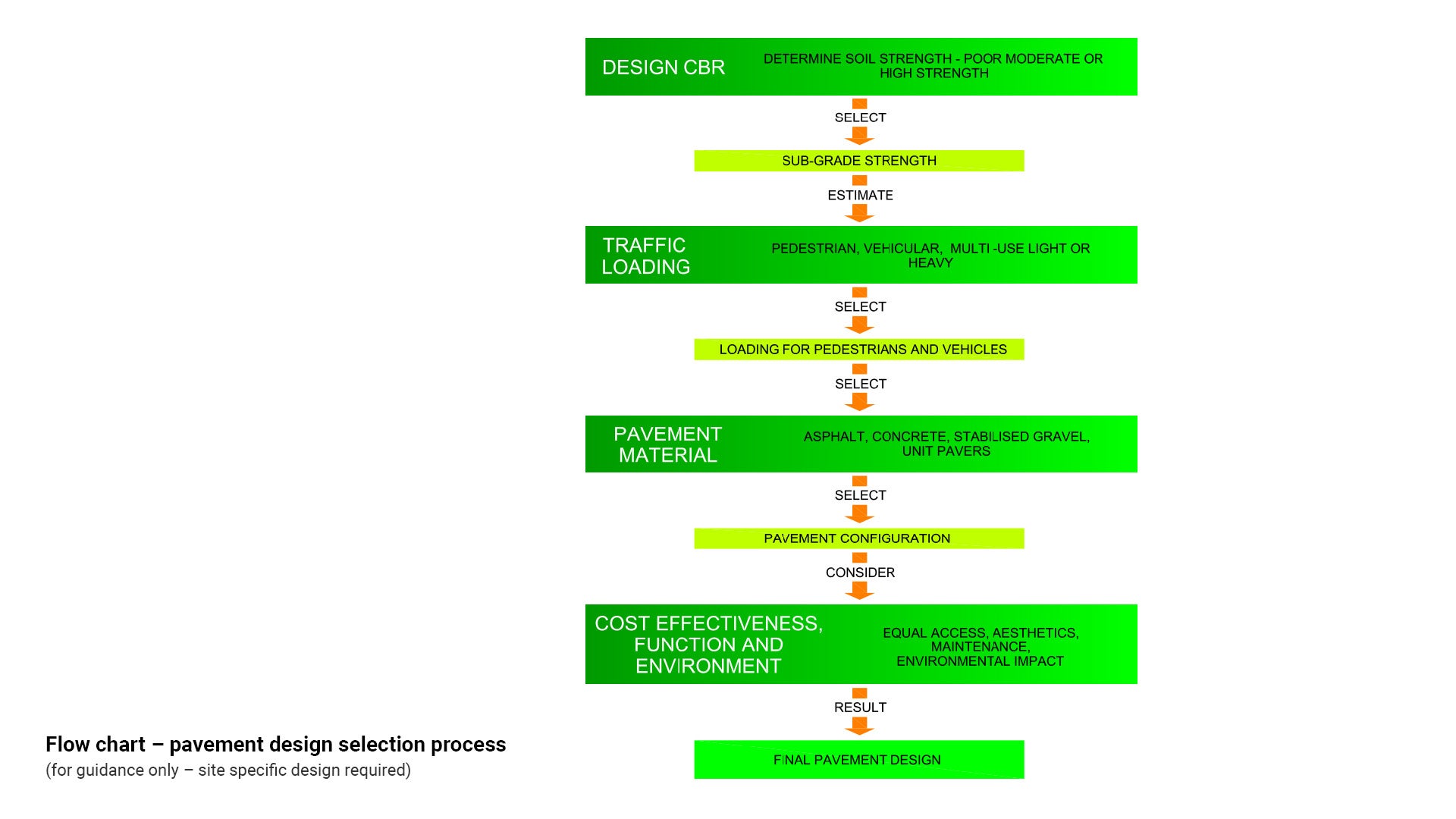
- Design of fire trails (unsealed roads) should be in accordance with Austroads Guide to Road Design and Austroads Guide to Pavement Technology Part 6: Unsealed Pavements.
- For basic pavement design process see Figure 7: Flow chart - pavement design selection process for further guidance.
- Road design is to be undertaken by a suitably qualified engineer.
Expected number of users
The estimated intensity of use and user demand for a has a substantial influence on design, construction, management and maintenance.
Establish current use and future demand through key stakeholder and peak user body consultation to ascertain the base line for minimum construction and design standards.
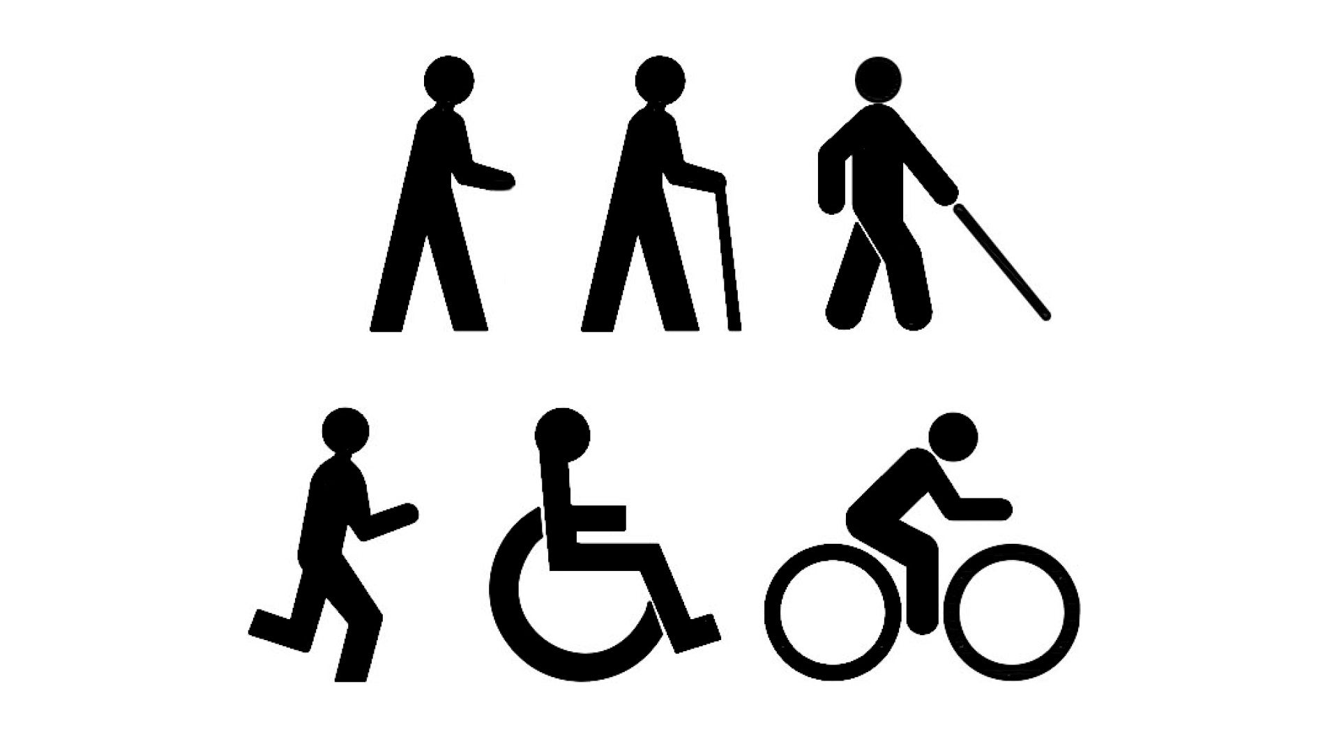
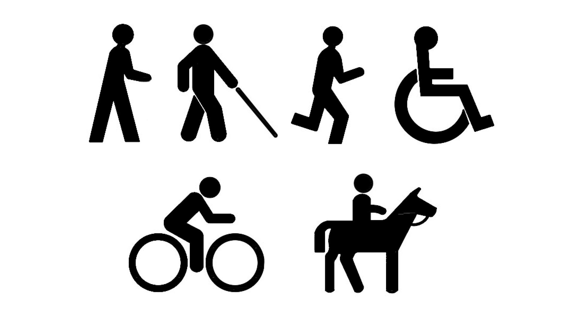
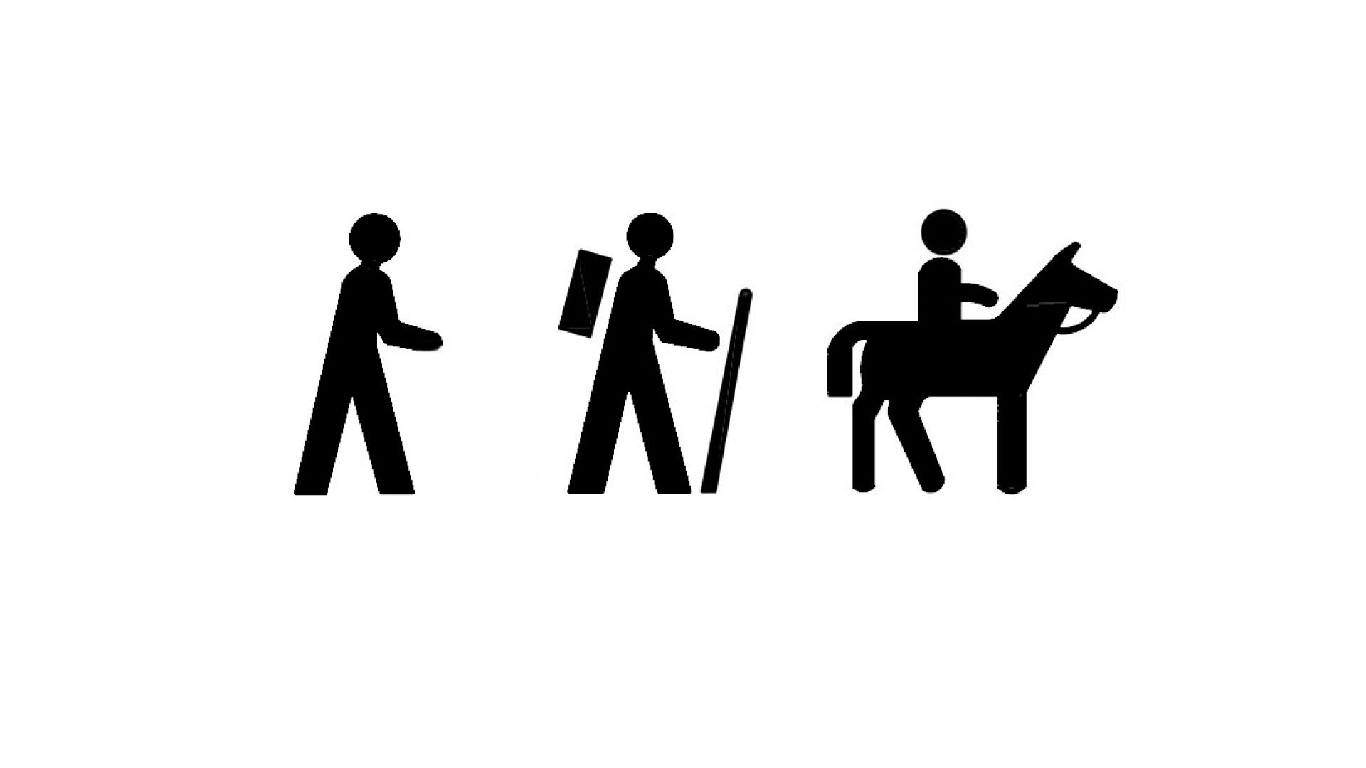
For design purposes PTT users may be categorised into local residents and tourists and these groups may to be further categorised into:
- walkers (includes cyclists and mobility devices).
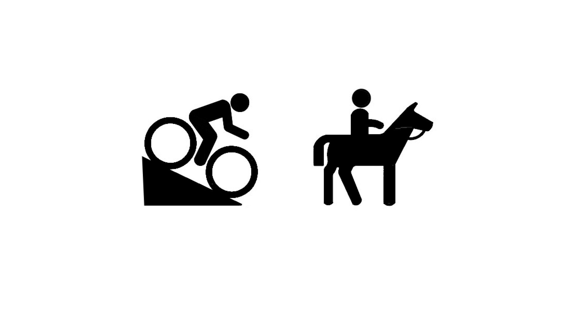
- mountain bike riders (includes family and cross country riders).
- runners.
- horse riders (includes recreational and long distance riders).
The designer needs to exercise professional interpretation and judgement to determine whether the potential active transport or recreational use, PTT will be:
- low use.
- medium use.
- high use (destination).
Recreational users (Australian Standard classes)

The LIM has adopted the Australian standard for walking tracks to classify paths/trails:
- AS 2156.1 – Walking Tracks – Classification and signage
- AS 2156.2 – Walking Tracks – Infrastructure design.
This classification has also been adopted by the Queensland Department of Infrastructure and Planning (DIP) in the document Draft South East Queensland Active Trails Implementation Guidelines 2010.
The PTT classification system allows the designer to select the ‘best fit’ classification for a proposed PTT which in turn informs the associated minimum required infrastructure that corresponds to the selected classification.
PTT classification may vary over a long section in order to accommodate changes in terrain, recreational opportunity and user requirements. These changes will be reflected in the level of embellishment selected (which is the minimum required for that classification).
Levels of embellishment profiled in the LIM are by no means fixed but are the minimum desirable ‘best practice’ and are flexible, encourage the designer to use professional interpretation, judgement, creativity and innovation in design (with the exception of embellishments which fall under mandatory Standards), or those required under other Australian Law:
- AS 1428.1, AS 1428.2, AS 1428.4.1, AS 1428.5 and AS/NZS 2890.6 mandate minimum requirements for access and mobility. The Sunshine Coast Council Access and Inclusion Plan demonstrates ‘council’s commitment to building inclusive communities where community participation and access enable people to move about our region with dignity, pride and independence.’
In the event that equal access requirements are unable to be provided (such as adverse topography), consideration should be given to include accessible elements which enable people with reduced mobility to be included in the outdoor experience. The following illustrates this concept:
- A PTT could include a dedicated equal access car park space with continuous accessible path of travel, leading to a viewing platform with compliant furniture. AS 1428.1 – Design for access and mobility – ‘A continuous accessible path of travel shall not include a step, stairway, turnstile, revolving door, escalator, moving walk or other impediment.’
The design should be inclusive of people with varying levels of ability. Avoid preconceived notions regarding the capability or desire for outdoor experiences, exercise or recreational activities. The following illustrates this concept:
- Council received a request for a rest seat at the conclusion of a PTT at a natural area waterfall. Elderly and injured people, who chose to undertake the walk, needed a seat in order to rest before undertaking the return journey. Council installed a rest seat which opened up the waterfall to a wider section of the community and is in line with the purpose of council’s Sunshine Coast Community Strategy. This equal access feature is promoted at the local information centre.
When designing any pedestrian pathway in Queensland, care should be taken to include cyclist safety provisions within the design. Queensland Government Road Rules make provision for cyclists to use any path as long as the cyclist keeps to the left and gives way to pedestrians, with the exception being if the path is signed ‘no bicycles.’ See Queensland Government road rules for cyclists which are applicable to both on-road and off-road bicycle paths.
For required lateral clearance to any obstacle, see Austroads Guide to Road Design Part 6A: Paths for walking and cycling. Required clearance to an obstacle beside a path is 300 mm (absolute minimum to a smooth fence), 500 mm minimum (to an obstacle which could injure a cyclist), 1.0 m preferred and 1.5 m desirable.
See the following tables for further guidance:
- Table 2: Summary path/trail relevant standards/legislation
- Table 3: Summary paths/trails relevant standards/legislation (bicycles)
- Table 4: Summary paths/trails peak user body classification system.
Table 2: Summary path/trail relevant standards/legislation
Legislation/standard | Legislation/standard content | Hierarchy | Classes/difficulty rating |
Australian Standards – Walking Tracks AS 2156.1, AS 2156.2 |
| Australian Standard adopted by Queensland Department of State Development, Manufacturing, Infrastructure and Planning and the Open Space LIM |  |
Australian Standards – Design for Access and Mobility AS 1428.1, AS 1428.2, AS 1428.4.1 |
| Mandatory Australian Standard referenced in Disability Discrimination Act (overarching Federal legislation) Mandatory compliance requirements referenced in Building Code Australia Disability (Access to Premises) - Buildings Standards are triggered when building approval is required | N/A |
Sunshine Coast Council – Recreation Trail Plan 2012 | The strategy considers paths/trails that cater for non-motorised urban and non-urban recreation | Sunshine Coast Council endorsed plan Note: path/trail classification used in the Recreational Trail Plan and SCC brochures differ from Australian Standards path classification |
|
Austroads guidelines |
| Department of Transport and Main Roads Road planning and design manual (2nd edition - Queensland supplements to the Austroads guidelines) | N/A |
Australian Horse Trail Riders Association (AHTRA) | Horse trail construction guidelines | AHTRA is the peak user body for horse trails |
|
Transport Operations (Road Use Management – Road Rules) Regulation 2009 | Mandatory road rules for cyclists – application for both on-road and off-road bicycle paths | Queensland Government Department of Transport and Main Roads | N/A |
Draft South East Queensland Active Trails Implementation Guideline | Guideline for trail development and planning for local government and path/trail planners | Department of State Development, Manufacturing, Infrastructure and Planning |
|
International Mountain Bicycling Association Trails Solutions (IMBA) | Bicycle trails construction guideline. | Peak user body for mountain bike trails. |
|
Table 3: Summary paths/trails relevant standards/legislation (bicycles)
Bicycle legislation/standard | Bicycle legislation/standard content | Hierarchy |
Manual of Uniform Traffic Control Devices (MUTCD) | Part 9 Bicycle Facilities Part 10 Pedestrian Control and Protection | Queensland Government Transport and Main Roads Manual takes precedence over TRUM manual (except when TRUM manual published after MUTCD). |
Traffic and Road Use Management Manual (TRUM) | Volume 1: Guide to Traffic Management Volume 2: Guide to Road Safety Volume 3: Signing and Pavement Marking Volume 4: ITS and Electrical Technology Manual | Queensland Government Transport and Main Roads Manual. |
Austroads guidelines | National Cycling Aspects of Austroads Guides. | Queensland Department of Transport and Main Roads |
Gearing up for active and sustainable communities | National Association Australian Bicycle Council Guideline National Cycling Strategy 2011–2016 | |
Cycling–Inclusive Policy Development: A Handbook | National Cycle Policy | Federal Ministry for Economic Cooperation and Development handbook. |
Technical Information for Cycling | Technical guideline | Queensland Department of Transport and Main Roads |
New South Wales Government Planning guidelines for walking and cycling | Queensland Department of Transport and Main Roads recommended guidelines to assist planners and related professionals | New South Wales Department of Infrastructure Planning and Resources guideline (road and transport authority) |
NSW bicycle guidelines | Queensland Department of Transport and Main Roads recommended best practice guideline. | New South Wales Road and Traffic Authority Guideline. |
Please refer to the relevant authority websites for updated information. The documents listed above are subject to amendments from time to time.
Table 4: Summary paths/trails – peak user body classification system
Symbol |  |  |  |  |  |
International Mountain Bike Rider Association (IMBA)
| Easiest
| Easy
| More difficult
| Very difficult
| Extremely difficult
|
Australian Trail Horse Rider Association (ATHRA)
| N/A | Easy (class 1 user difficulty rating)
| Intermediate (class 2 user difficulty rating)
| Advanced (class 3 user difficulty rating)
| N/A |
Classification tables
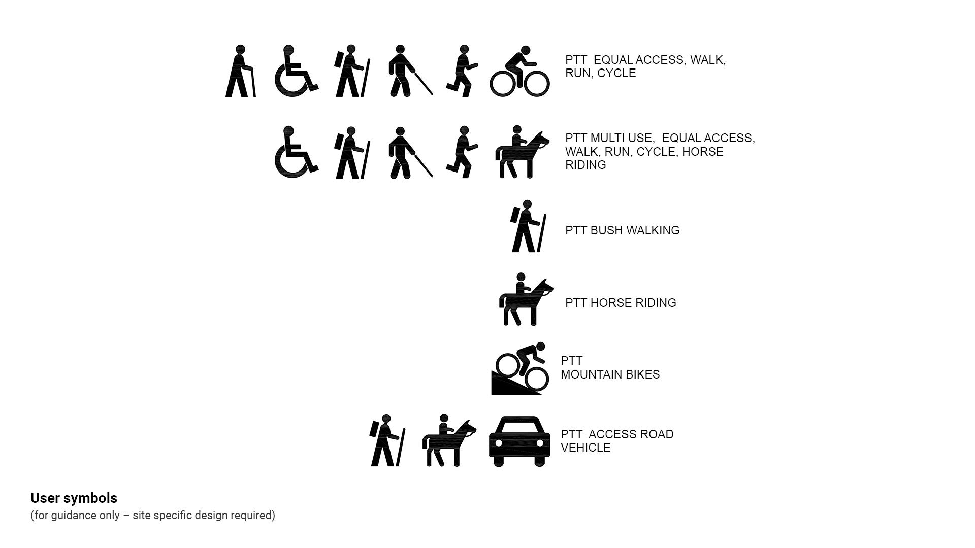
Symbols used in LIM tables
Symbols included in the following tables are indicative only and not Council approved for uses such as signage.
Where a wheelchair symbol is required (such as for signage), select the International Symbol of Access (ISA), also known as the wheelchair symbol.
See the following for further guidance:
- LIM Signage
- Figure 4: User symbols.
Figure 4: User symbols
See the following tables for further guidance:
- Table 4: Summary path/trail peak user body classification system (above)
- Table 5: Summary path trail classifications – Classes 1 – 4
- Table 6: Standards and key considerations – Class 1
- Table 7: Standards and key considerations – Class 2
- Table 8: Standards and key considerations – Class 3
- Table 9: Standards and key considerations – Class 4 and 5.
Table 5: Summary path trail classifications – Classes 1 – 4
Category and class | Key considerations | Typical users | Typical examples |
PATHS  Authority: Council |
|  |
|
PATHS  Authority: Council |
|  |
|
TRAILS  Authority: Council |
|  |
|
TRAILS  Authority: Council |
|  |
|
TRACKS  Authority: Council |
|  |
|
TRACKS  Authority: State - Department of National Parks, Sport, Recreation and Racing responsibility |
For path/trail head parking, drainage, facilities and signage, see corresponding LIM category for further guidance.
Note: Paths/trails/tracks may be comprised of sections with different attributes from a variety of categories such as 1/2, 2/3, 4/5. The overall category is usually a description of the section of path/trail/track with the highest requirement.
Table 6: Standards and key considerations – Class 1
Class | Relevant standard | Key considerations |
CLASS 1  AS 2156.1 Walking tracks – classification and signage | Australian Standards for Walking Tracks
|
|
Australian Standards for Access and Mobility
|
| |
Guide to Road Design (Austroads)
|
| |
Transport Operations (Road use management - road rules) Regulation 2009 – Queensland Road Rules (Department of Transport and Main Roads). |
| |
Draft South East Queensland Active Trails Implementation Guideline (Queensland Government Department of State Development, Manufacturing, Infrastructure and Planning) |
|
Table 7: Standards and key considerations – Class 2
Class | Relevant standard | Key considerations |
CLASS 2  AS 2156.1 Walking tracks – classification and signage | Australian Standards for Walking Tracks
|
|
Australian Standards for Access and Mobility
|
| |
Guide to Road Design (Austroads)
|
| |
Australian Horse Trail Riders Association (AHTRA) (construction requirements) |
| |
Transport Operations (Road use management - road rules) Regulation 2009 – Queensland Road Rules (Department of Transport and Main Roads). |
| |
Draft South East Queensland Active Trails Implementation Guideline (Queensland Government Department of State Development, Manufacturing, Infrastructure and Planning) |
|
Table 8: Standards and key considerations – Class 3
Class | Relevant standard | Key considerations |
CLASS 3  AS 2156.1 Walking tracks – classification and signage | Australian Standards for Walking Tracks
|
|
Australian Standards for Access and Mobility
|
| |
Guide to Road Design (Austroads)
|
| |
Transport Operations (Road use management - road rules) Regulation 2009 – Queensland Road Rules (Department of Transport and Main Roads). |
| |
Australian Horse Trail Riders Association (AHTRA) (construction requirements) |
| |
Draft South East Queensland Active Trails Implementation Guideline (Queensland Government Department of State Development, Manufacturing, Infrastructure and Planning) |
|
Table 9: Standards and key considerations – Class 4 and 5
Class | Relevant standard | Key considerations |
CLASS 4  AS 2156.1 Walking tracks – classification and signage | Australian Standards for Walking Tracks
|
|
Australian Horse Trail Riders Association (AHTRA) (construction requirements) |
| |
Draft South East Queensland Active Trails Implementation Guideline (Queensland Government Department of State Development, Manufacturing, Infrastructure and Planning) |
| |
CLASS 5  | International Mountain Bicycling Association Trail Solutions (IMBA) 2007 |
|
Vehicle users (Austroads classes)
It is important to identify the potential vehicles that may enter a park, in order to determine design specifications for surface materials, in relation to potential vehicle load ratings.
Generally, we need to consider:
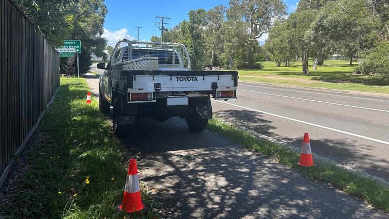
- council’s Parks and Gardens maintenance vehicles (e.g. 4WD, chipper, ute, crane).
- emergency vehicles (ambulance, fire, police, SES, surf lifesaving).
- regulatory vehicles (police and council’s regulatory services e.g. quad bikes).
- public recreational vehicle access crossing a pathway such as a short vehicle towing a boat to a ramp.
- public recreational coaches transporting people to a destination.
Most path/trail vehicle crossovers should be designed to withstand an Austroads Class 3 Vehicle (the larger maintenance truck and chipper) as these vehicles need to cross a path regularly. Therefore a thicker slab, compacted subgrade and reinforcing is required.
In some locations the path/trail must be designed for a heavier load where excavators and larger dump trucks (carrying a load), would be used regularly. Consult a specialist designer for vehicle crossover design.
Large truck vehicle design considerations occur at a location such as an intermittently closed and open lake or lagoon (ICOLL). Sand maintenance is regularly undertaken. In order to determine load requirements, Austroads provides guidance relative to the vehicle class.
Vehicle classes are as follows:
- Class 1 – short vehicle
- Class 2 – short vehicle towing
- Class 3 – two axle truck, bus or excavator.
See the following:
- Figure 5: Plan – beach maintenance vehicle crossover
- Figure 6: Austroads vehicle classifications
- Figure 7: Flow chart – pavement design selection process.
Figure 5: Plan – beach maintenance vehicle crossover
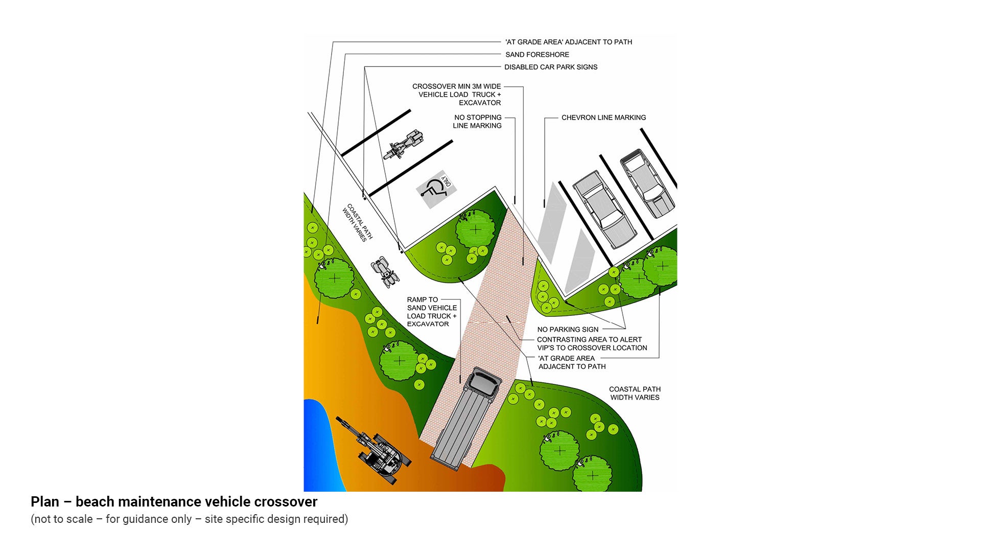
Figure 6: Austroads vehicle classifications

Figure 7: Flow chart – pavement design selection process
This component is currently in development