Suite of signs

Interpretive signs
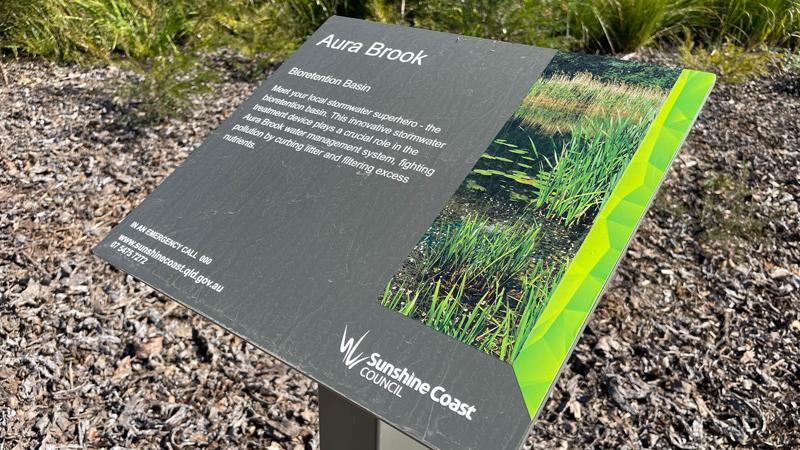
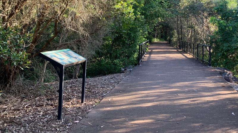
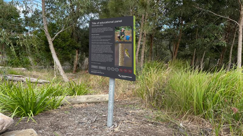
Interpretive signs, also referred to as an 'information sign' or 'education sign'. This sign type is typically located along a trail or park environment where there are points of interest. The sign provides educational content about the surrounding area, usually supported by photography and or illustrations.
Download the full LIM Signage suite Catalogue.
Technical drawings and artwork templates
Embellishment | Technical dwg/artwork templates | Supplier |
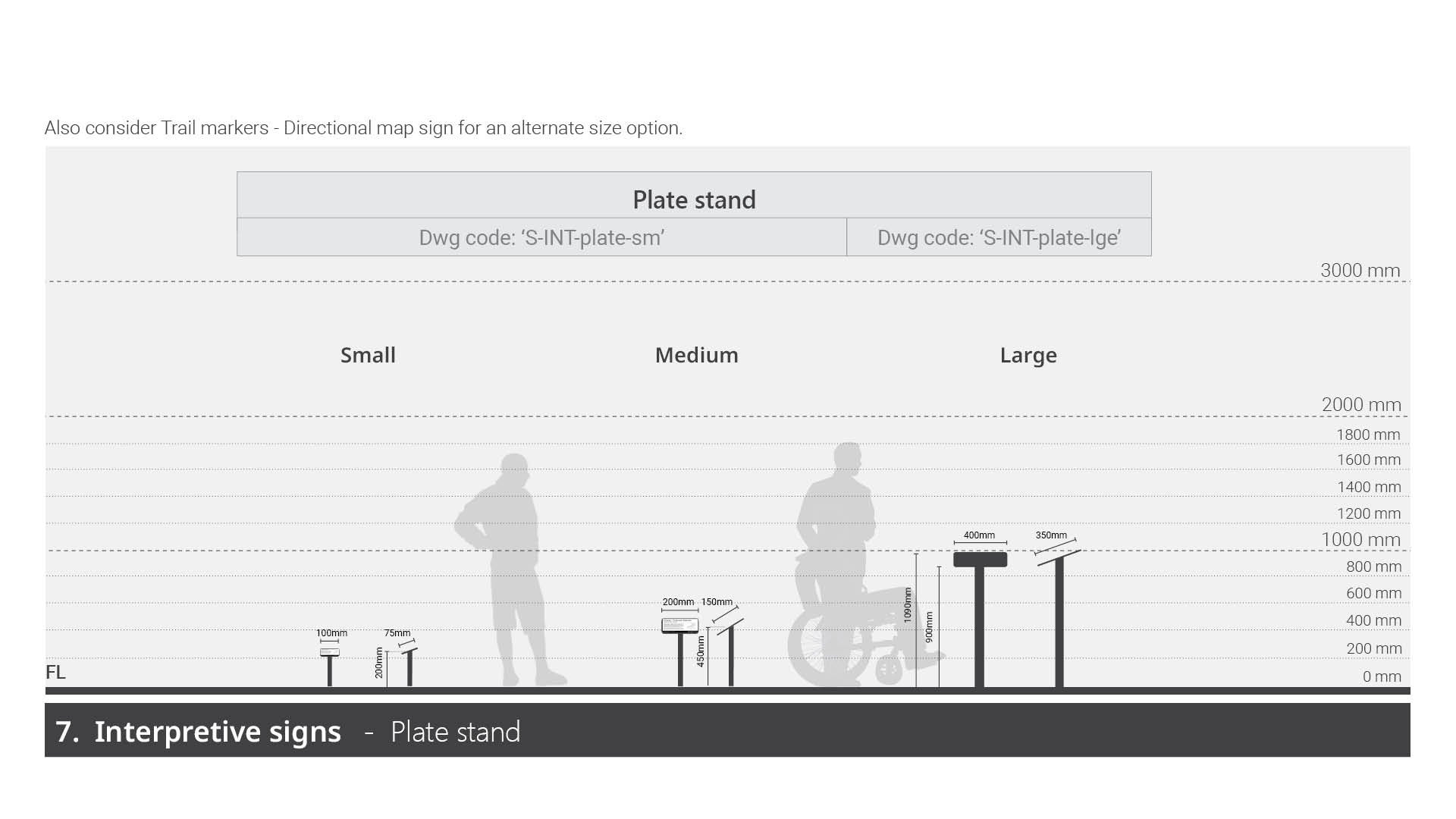
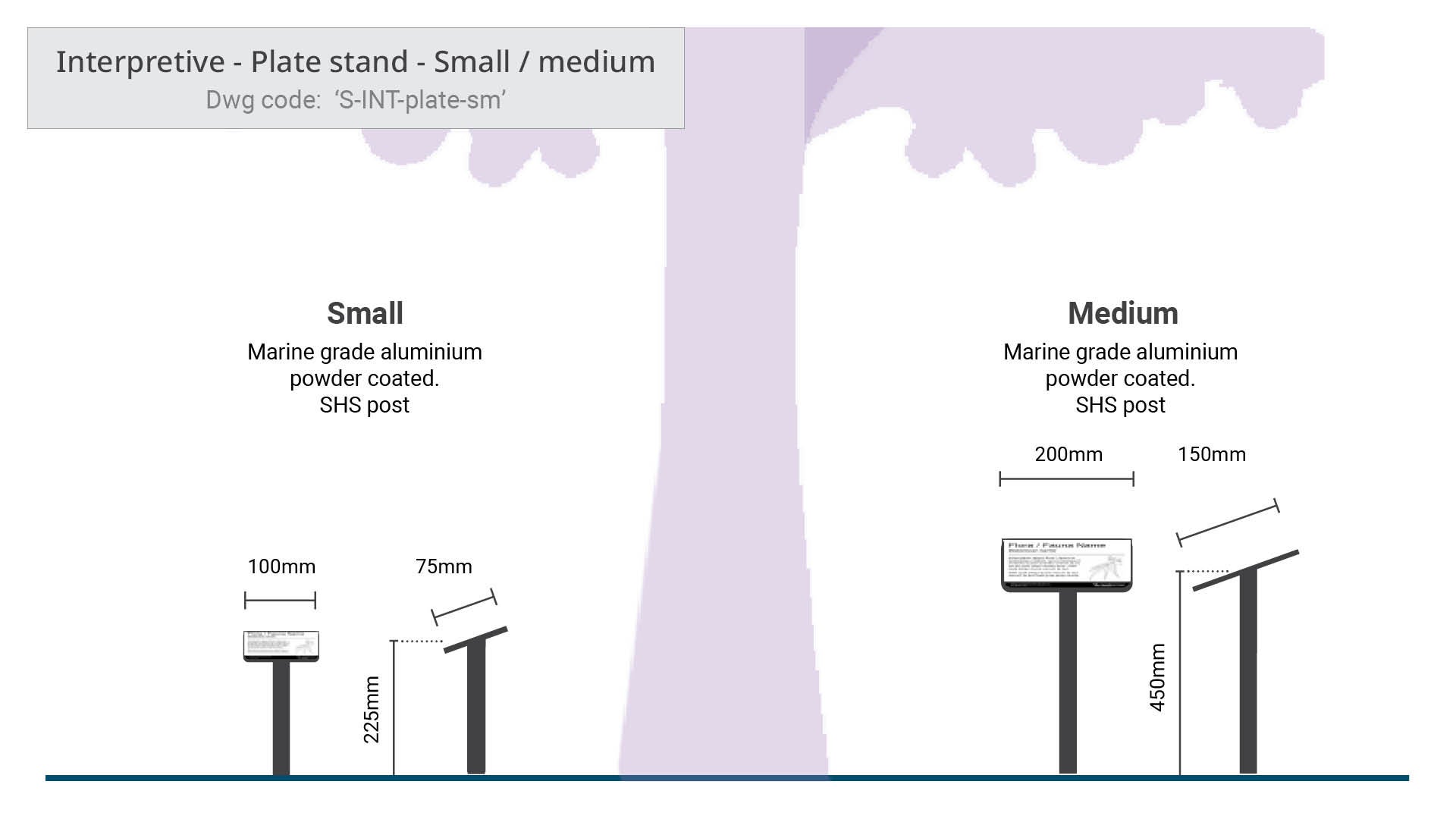 | Interpretive - Plate stand - small/medium
| No Supplier specified |
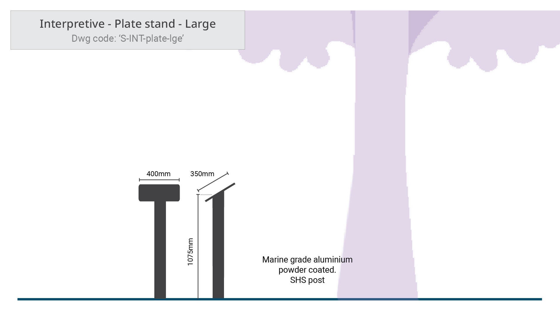 | Interpretive - Plate stand - large
| No Supplier specified |
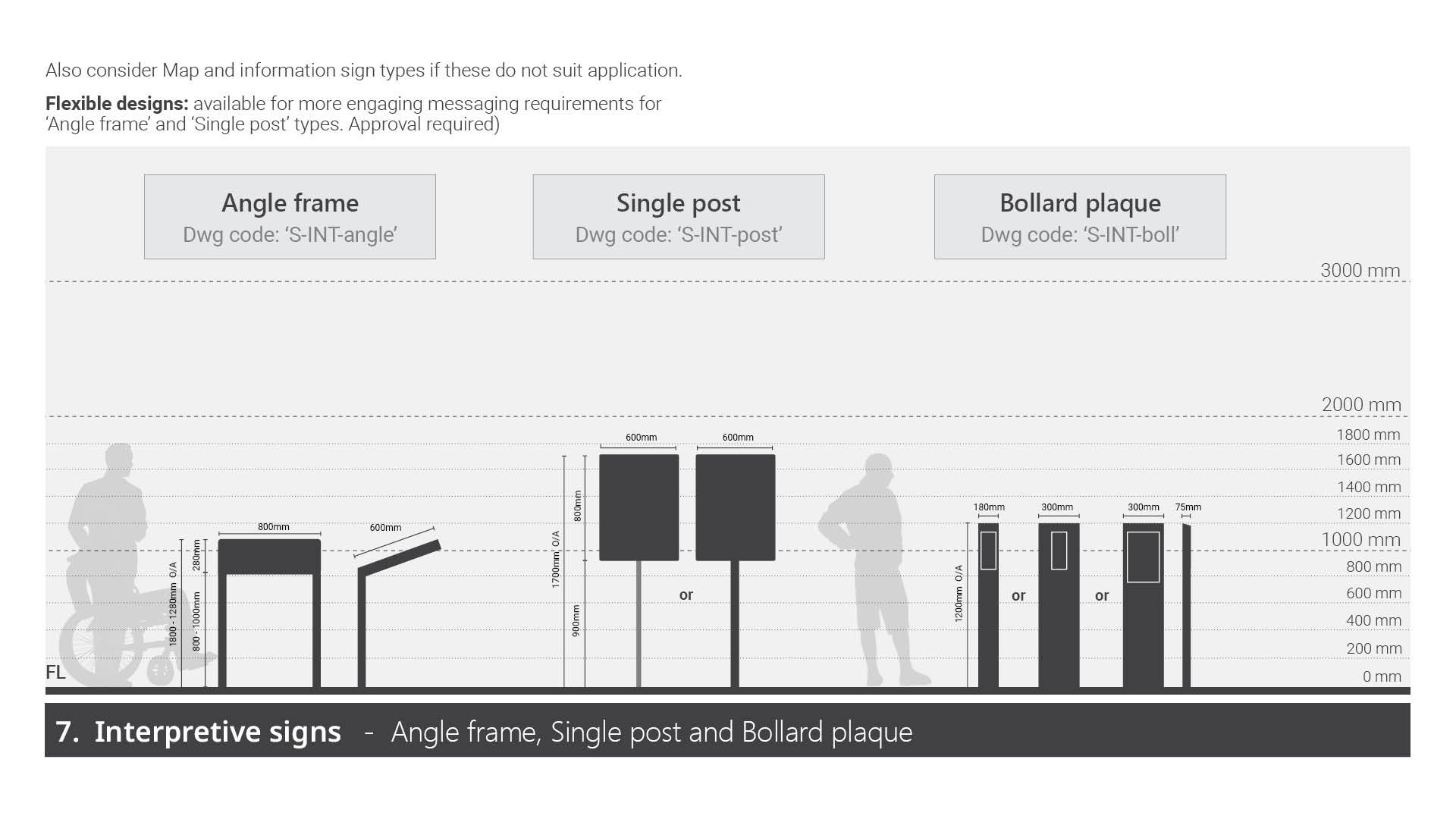
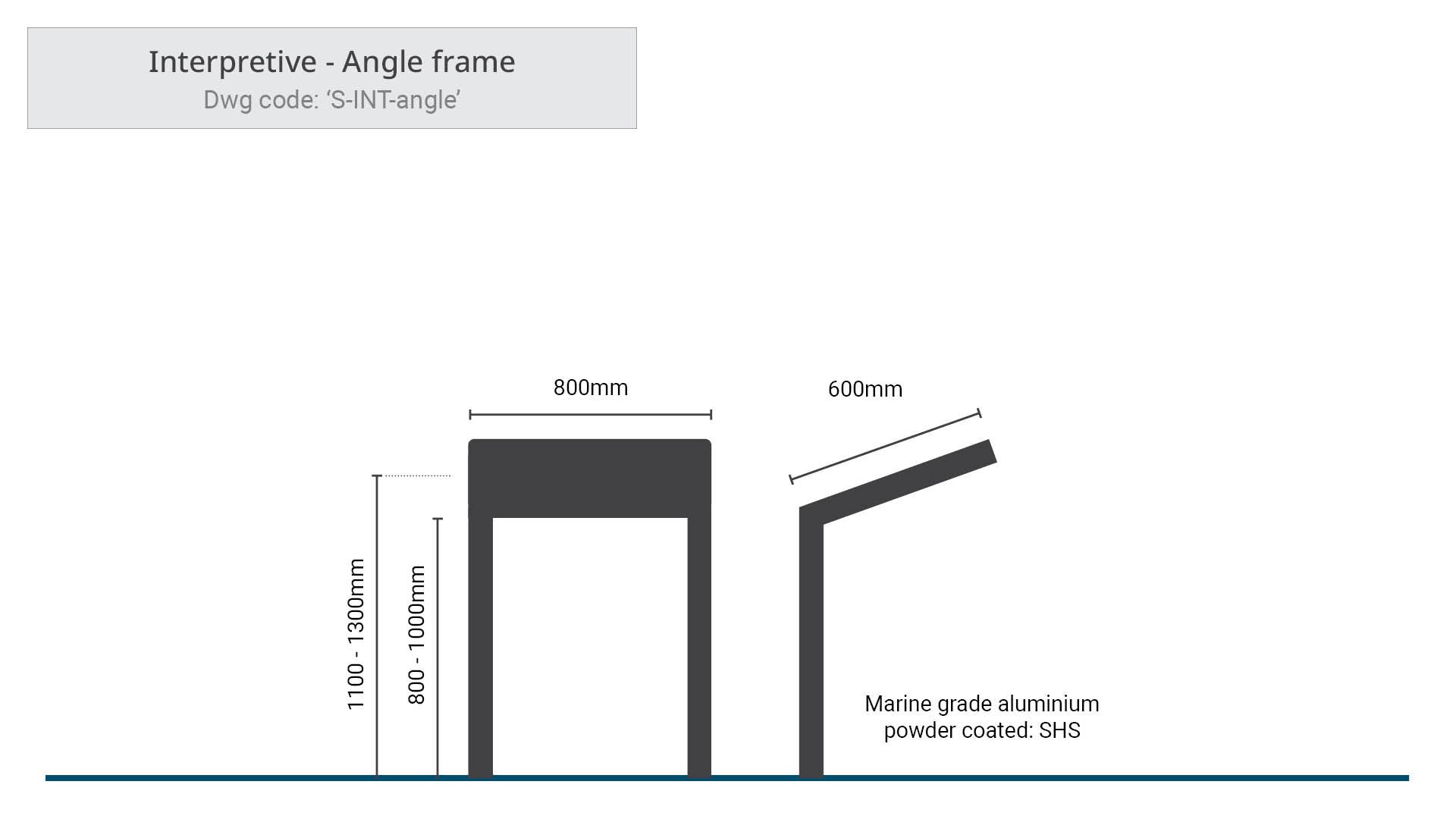 | Interpretive - Angle frame
| No Supplier specified |
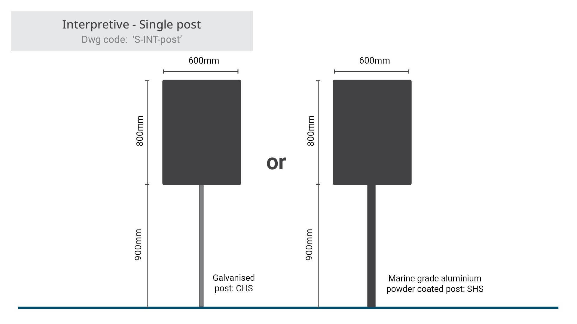 | Interpretive - Single post
| No Supplier specified |
 | Interpretive - Bollard plaque
| Replas (or equivalent) |
Purpose
Interpretive signs are typically installed to provide additional information to educate the reader, as well as enhance the experience for recreational users.
These signs are usually located at a destination or at locations along a pathway. The sign is not required to be part of a set of signs throughout an open space, the sign may be stand-alone.
Interpretive signs may be used in the following instances:
- self-guided pathways
- creating stopping points/highlighting points of interest, such as viewing areas, flora and fauna, cultural and or historical information.
Interpretive signs are long message signs (excluding small and medium plate stand types) that provide informative content supported by photographs or illustrations about elements in the surrounding area.
The suite includes four sign types to suit a variety of uses:
- Plate stand
- Angle frame
- Single post
- Bollard plaque.
Plant stand - there are three sizes and may be located in both low and high profile locations:
- Small and medium
- Used to display plant and tree species names, where there is limited space or the sign needs to be close to the tree it identifies.
- The small and medium plate stands would typically be positioned within view of a nearby path or trail.
- Large
- Used to display educational content along a trail network, without intruding on natural views and landscape.
- The sloped sign panel, makes this sign the most comfortable design for reading.
Angle frame
This sign is the most commonly used in the family of Interpretive signs. It is installed along path of travel. Angle framed signs are long message signs selected to display educational content.
- Typically used where the content may require a longer time to read.
- The sloped design persuades the reader to look at the subject or in the direction of the subject while reading about it.
Single post - Preferably installed in low profile locations
- The upright design may not encourage a long reading time as looking up to the sign is less comfortable, (consider using the Angle frame due to the slope design makes the sign more friendly to read).
- Suitable for installing where space may be restricted.
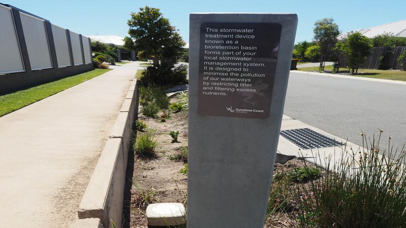
Bollard plaque
This sign may be located in both low and high profile locations, positioned off any path of travel to avoid interrupting passing foot traffic.
- Bollard plaque signs are short message signs selected to display educational content quickly.
- The plaque would typically be positioned within view of a nearby path or trail or in a garden.
- The artwork layout template has been designed to be installed within a raingarden/bioretention system. This template may also be modified to suit other scenarios and content to suit site.
Planning
General
The following should be considered prior to installing the sign:
- Consider the content to be displayed.
- Determine the best location to promote content.
- Calculate the number of signs required.
- If multiple signs are to be installed, determine if they will contain the same content or different material.
- Plan to incorporate Crime Prevention Through Environmental Design Guidelines (CPTED) such as ‘retain sight lines’ at the design stage of a sign project, to avoid ongoing maintenance costs such as, lift pruning of trees and vegetation, or costly re-design to enhance public safety.
Choosing between sign types
Selection of Interpretive sign types should consider the following:
- The level of use of the site (high use or low use).
- Amount of space available for a sign/s at the site.
- The volume of content required to provide the necessary information (graphic templates provide approximate word count for planning guidance).
- The type of information to be displayed.
- The duration a user may require to read and reflect upon the provided information.
Design
Legal, standards and guidelines, requirements
Sign construction
- Technical drawings (DWGs) - for typical construction details for each sign type. See Technical drawings and artwork templates table (above - top of page).
- Artwork templates and samples - for approved graphic design templates and samples for alternative options (where applicable) for each sign type. See Technical drawings and artwork templates table (above - top of page).
See LIM Signage – Overarching guidelines – for Standards such as, designing for access and inclusion, traffic and road standards (where applicable).
Content and corporate branding
- Sunshine Coast Council corporate branding logo must be displayed on all signs as per Artwork templates.
- All colours must be selected from the Council corporate colour palette or otherwise approved for specific purpose. e.g. some colours, such as red, yellow and black, (not part of the corporate palette) may be used for regulatory purposes.
See LIM Signage – Graphic design guidelines – for essential guidance on components that make up signs. e.g. colour application, pictogram integration, text sizing and spacing, map implementation etc.
Content general
- All sign artwork is to be professionally designed (by a qualified graphic designer or equivalent) as vector files.
- Sign content must use a positive tone. This will influence the reader to embrace the message.
- Sign content must be accurately researched and approved by council asset custodian prior to print.
- Sign content must have an engaging title and subtitles where applicable, to attract the audience.
- All photography and illustrations must be high resolution and the subject must be clear.
- Photographs must have written approval for use by the owner prior to use.
- Written permission on an council talent release form is required by any person who may be identified in a photograph.
- All regulatory pictograms must be approved by Council (Community Response) prior to printing.
- Corporate branding banner
- Emergency contact information
- Council contact details (report defects/issues).
- Items not regulated by Council should not be included. Campaign content should not be included as they are subject to change.
Positioning
General
- When considering potential sign locations, avoid positions where the sign may interrupt or block a prominent view. Signs should be secondary to a natural view. However, safety is paramount.
- Position signs in a planted area where possible, for ease of maintenance mowing, and to potential for avoid pedestrian collision.
- To ensure a sign panel will not be obscured in future, consider mature size of surrounding vegetation.
- To protect trees from potential damage, all signs should be installed outside of their canopy areas (drip lines). Where this is not possible, the Project Arborist should be contacted to provide advice. See LIM Site set up (including Tree protection) for further guidance.
- Where there is an existing or new pathway, all signs must meet Austroads minimum 500 mm safety offset from any path edge, to avoid collision with the sign while using the pathway.
- Position signs a minimum of 200 mm in from any slab or compacted surface edge for mowing offsets (where applicable) and visual appearance.
Additional requirements
- These signs are typically located in environmental reserves should be installed 500 mm minimum off a trail, within a compacted surface treatment pad area. This applies to the following sign types only:
- Plate stand - Large
- Angle frame
- Single post.
- Where a sign is installed beside a new concrete pathway, a luminance contrast treatment is recommended to form the sign slab and must extend the full width of the path of travel. This treatment enables people with low vision and people who are blind to identify a sign or facility adjoining a pathway.
- Where an existing pathway is less than 2.0 m wide, a sign viewing slab or compacted surface treatment is required. This provides an area for viewing the sign while not blocking the path of travel.
- These signs are designed to contain long message content. The median sign viewing height must be between 1.2 m – 1.7 m from the finished surface level.
- To accommodate a long message sign, the sign viewing slab or compacted surface treatment is preferred to be 1.3 m with a width to suit the sign plus 200 mm mowing offset, all round (where required). The sign viewing slab provides space for a wheelchair or group of people, to stand at the sign while not obstructing the path of travel.
See the following for further guidance:
- Figure 22: Typical positioning – Interpretive signs in a high profile location
- Figure 23: Typical positioning options – Interpretive signs in a low profile location.
Figure 22: Typical positioning – Interpretive signs in a high profile location
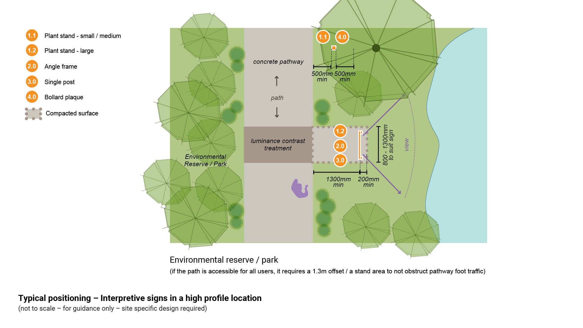
Figure 23: Typical positioning options – Interpretive signs in a low profile location

Delivery
For all developer delivered assets, contact Council (Development Services) – this includes all works associated with any development application.
For all council delivered assets, the following process should be used:
Site investigations
- Confirm council land tenure and approval process.
- Identify sign location.
- Identify physical/technical constraints.
- Obtain arborist advice (where required).
Community engagement/stakeholders
- Where applicable.
Corporate liaison and approvals
See the Technical drawings and artwork templates table in each sign type page for guidance - How to place an artwork order (internal use only) and Artwork design instructions (internal use only).
- Council (Parks and Gardens) and or Council (Environmental Operations).
- initial approval for use/application of sign.
- approval and guidance of artwork content.
- approval to manufacture signs.
- approval of location of signs.
- Council (Community Response)
- approval of any regulatory signage/componentry.
- Council (Communication)
- editing of templates
- supply of proofs for approval
- approval of corporate branding.
Deliverables
- Site plan – for sign installation.
- Technical drawings (DWGs) – sign construction details.
- Schedule of signs.
Manufacture
See the Technical drawings and artwork templates table in each sign type page for guidance - How to place an artwork order (internal use only) and Artwork design instructions (internal use only).
- In-house manufacture – Council (Transport Network Operations) - Civil Operations (Signs Technical Officer).
OR
- External manufacture – select a suitable sign fabricator.
Installation
- All relevant key stakeholders are to be notified (including contractors), and where required, attend a pre-start meeting.
- Sign location as per approved site plan.
- Installation as per technical drawings and schedule.
Finalisation
- Assets captured.
- As designed as constructed drawings (ADAC) supplied.
- Hand over to asset custodian.
This component is currently in development